Search

Search Results

Kaart van het eiland Borneo

event1899

location_onMalaysia, Indonesia, Brunei

This map of Borneo is divided between two residencies of the Dutch East Indies (Residentie Westerafdeeling van Borneo and Residentie Zuider en Oosterafdeeling van Borneo), and the British protectorates of Sarawak and British North Borneo.

Overzichtskaart van de Residentie Besoeki

event1899

location_onIndonesia

This map of the residency of Besoeki (Banyuwangi Regency, East Java) is divided into regencies and districts. Heights of mountains and settlements are given in metres, and distances are shown along roads. Sugar factories and fishing ponds are marked.

Baaien op de Zuid- en Westkust van Celebes

event1899

location_onIndonesia

Two maps of bays of Celebes (Sulawesi), including bathymetry (sea depth), reefs and shoals, and coastal hills to use as landmarks. Obstructions in the water are marked ‘kr’ for coral, ‘m’ for mud, ‘st’ for stones, and ‘z’ for sand.

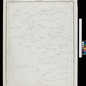
Kaart der residentie Zuider- en Ooster-afdeeling van Borneo

event1899

location_onIndonesia

On this map, the residency of South and East Borneo is divided into departments (green borders) and provinces (yellow borders). There is an inset plan of the city of Banjarmasin, with rivers, buildings, residential areas, roads and crops marked.

Kaart van het eiland Borneo

event1899

location_onBrunei, Indonesia, Malaysia

This map of Borneo is divided between two residencies of the Dutch East Indies (Residentie Westerafdeeling van Borneo and Residentie Zuider en Oosterafdeeling van Borneo), and the British protectorates of Sarawak and British North Borneo.

A map of British North Borneo

event1899

location_onMalaysia, Brunei, Indonesia

The colonial territories of British North Borneo are shown in pink on this late 19th century map, with Brunei and Sarawak in green, and Dutch colonial territory in yellow. Sea routes around the British Empire are depicted on an inset map.

Sumatra

eventc.1899-1902

location_onIndonesia

Eight sheets from a large-scale detailed topographic map of Sumatra (many other sheets are missing). Includes crops (rice, coconut, coffee, banana, sugar, gambier, cinnamon, bamboo, alang-alang, arenga palm), routes (railways, roads), settlements.

Upper Burma

event1899

location_onMyanmar, Thailand

Map of Upper Burma, showing the borders with Assam (India), China and Siam (Thailand), as well as internal administrative borders. Mountains with their heights, settlements, rivers and railways (completed, proposed and under construction) are shown.

India shewing railways with stations

event1899

location_onMyanmar

This map focuses on India, but also includes Burma (Myanmar), showing the country’s railway lines with their stations, including engine changing stations and junction stations. Part of a series of maps charting the development of the railway system.

Skeleton map of India

event1899

location_onMyanmar

On this map of India, Burma (Myanmar) is divided into two regions: ‘British Burma’—under British colonial rule after the Second Anglo-Burmese War (1852)—and Upper Burma (labelled ‘Burma’), under British rule after the Third Anglo-Burmese War (1885).

Chart of triangulation: No.21 Party, Northern Shan States (Upper Burma)

event1899

location_onMyanmar

A triangulation map of part of Upper Burma (Myanmar), showing dozens of locations joined with straight lines to create a triangulation network.

Geologische skizze von Nord-Celebes

event1899

location_onIndonesia

Geological map of the Minahasa Peninsula, Celebes (Sulawesi) showing rock types. Two more topographical maps show the terrain of the northeast tip of the peninsula, with elevation views including of the volcano Mount Klabat.

close