Search

Search Results

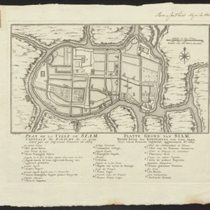
Plan de la Ville de Siam: Capitale du Royaume de ce nom = Platte grond van Siam: Hoofd stad des Koningryks van dien' naam

event1687

location_onThailand

Map of the Siamese city of Ayutthaya (‘Ville de Siam’), surrounded by the Menam River (Chao Phraya River). Roads and buildings are marked, including a number of royal palaces and pagodas, which are listed on the Dutch and French-language legend.
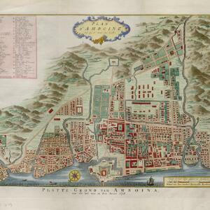
Plan d'Amboine, tel qu'il étoit en 1718 = Platte-grond van Amboina, zoo als het was in den jaare 1718

eventc.1746-1770

location_onIndonesia

This colourful mid-18th century plan of the city of Amboine (Ambon, capital of Ambon Island, in the Maluku Islands, Indonesia) has a detailed legend identifying locations within the city and the surrounding mountains. The text is in French and Dutch.

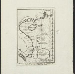
Carte des costes de Cochin Chine, Tunquin, et partie de celles de la Chine

event1747

location_onVietnam, Cambodia

Map of the eastern coast of mainland Southeast Asia (modern Vietnam and part of Cambodia), divided into Tsiampa, Kochinchine and Tunquin. The shoals and reefs of the Paracel Islands are marked. The text is in French and Dutch.

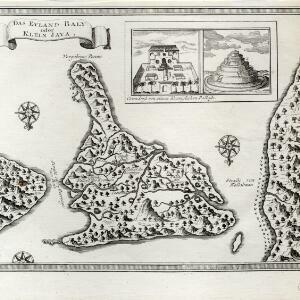
Das eyland Baly oder klein Java

event1750

location_onIndonesia

Amongst the mountains and jungles of mid-18th century Bali, this map shows three royal palaces, walled encampments, towns, and seven Buddhist temples (or ‘stupa’) on the east coast. Inset illustrations depict a palace and a temple in detail.

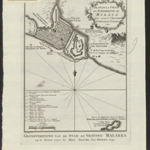
Plan de la ville et forteresse de Malaca = Grondtekening van de Stad en Vesting Malakka

event1750

location_onMalaysia

This mid-18th century plan of the city of Malaca (Malacca/Melaka) focuses on the military fort (‘A Famosa [The Famous]’), but also includes two churches, a mosque and a Chinese temple. Two markets are also marked, as is the entrance to the port.

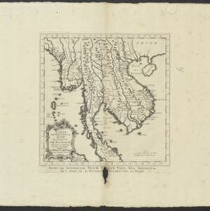
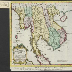
Carte des Royaumes de Siam, de Tunquin, Pegu, Ava, Aracan &c.

eventc.1755

location_onCambodia, Laos, Malaysia, Myanmar, Thailand, Vietnam

The kingdoms of mid-18th century mainland Southeast Asia are shown on this map: Ava and Pegu (Myanmar), Siam (Thailand), Tonquin and Cochinchine (Vietnam), Camboie (Cambodia) and Laos. The text is in French, with the title also in Dutch at the base.

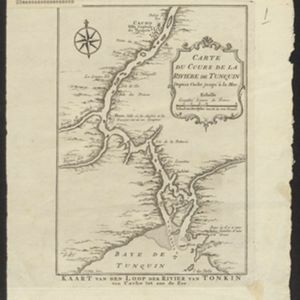
Carte du Cours de la Riviere de Tunquin: depuis Cacho jusqu'à La Mer

event1755

location_onVietnam

Map of the Tunquin River (Red or Hong River) from the city of Cacho (Hanoi, Thailand) to its mouth. At the mouth, bathymetry (sea depth), shoals and anchor points are marked. A place named Hean is labelled as an English and French trading post.

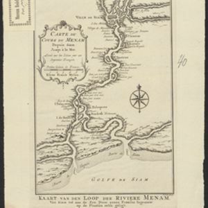
Carte du Cours du Menam: Depuis Siam Jusqu à la Mer

event1755

location_onThailand

Map of the Menam River (Chao Phraya River) from the city of Ayutthaya (labelled ‘Ville de Siam’), past Bangkok to its mouth in the Gulf of Thailand. Features forts, villages, and a royal palace along the route.

close

  • Filter from 1687 to 1773

Current results range from 1687 to 1773