Search

Search Results

Atlas van Nederlandsch Oost-Indië

eventc.1897-1904

location_onIndonesia

Very detailed atlas of the entire Dutch East Indies, over 16 map sheets, with a cover and overview map. Includes topographic maps, inset maps of cities and islands, and maps featuring land and sea routes, languages, geology, colonial territory etc.

Kaart van den Nederlandsch Oost Indischen archipel aantoonende de door de Inlandsche bevolking beleden godsdiensten

event1896

location_onIndonesia

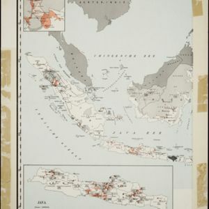
A map of the religions of the local peoples of the Dutch East Indies, with areas marked as Christian, Muslim, ‘heathen’. With population figures, including for Protestants and Catholics, and locations of missionaries and other religious teachers.

Kaart van de dichtheid van bevolking van Java en Madoera

event1892

location_onIndonesia

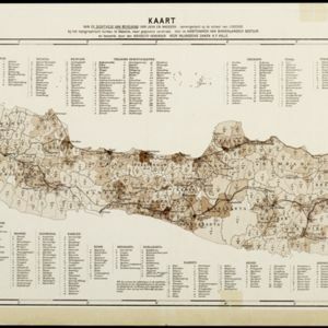
This map shows the population density of Java and Madura in 1892. The area is divided into regencies, which are then subdivided into districts, with the districts shaded to represent its population. Each district is also listed under its regency.

Asiatic archipelago

event1876

location_onVietnam, Myanmar, Papua New Guinea, Philippines, Singapore, Southeast Asia, Thailand, Malaysia, Laos, Indonesia, East Timor, Cambodia, Brunei

This late 19th century map of Southeast Asia shows the best maritime routes around the region, according to the time of year. There are also inset maps highlighting the rivers and southern islands of Singapore, and the sea depth around Labuan Island.

Topographische kaart der residentie Kadoe

event1870

location_onIndonesia

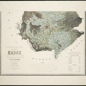
The residency of Kadoe (Kadu), Central Java, is shown divided into regencies and districts, with population figures for each district. Villages (kampongs) and towns, fields, mountains, rivers and roads are marked. There is an inset triangulation map.

Asiatic archipelago

event1858

location_onVietnam, Myanmar, Papua New Guinea, Philippines, Singapore, Southeast Asia, Thailand, Malaysia, Laos, Indonesia, East Timor, Cambodia, Brunei

This late 19th century map of Southeast Asia shows the best maritime routes around the region, according to the time of year. There are also inset maps highlighting the rivers and southern islands of Singapore, and the sea depth around Labuan Island.

S.E. Peninsula and Malaysia

event1849

location_onBrunei, Cambodia, East Timor, Indonesia, Laos, Malaysia, Myanmar, Papua New Guinea, Philippines, Singapore, Southeast Asia, Thailand, Vietnam

The colonial possessions of Britain, the Netherlands, Spain, Portugal and Denmark are shown on this mid-19th century map of Southeast Asia. There are inset maps of Penang Island and Singapore, and text describing the region’s colonial history.

Kaart van de Nederlandsche bezittingen in Oost-Indië

event1840

location_onBrunei, East Timor, Indonesia, Malaysia, Philippines, Singapore

This map shows the Dutch colonial possessions in the East Indies in the mid-19th century. The text provides great detail about the people, religion, crops, animals, geography and administration of the Dutch East Indies.

Asiatic archipelago

event1840

location_onVietnam, Myanmar, Papua New Guinea, Philippines, Singapore, Southeast Asia, Thailand, Malaysia, Laos, Indonesia, East Timor, Brunei, Cambodia

This late 19th century map of Southeast Asia shows the best maritime routes around the region, according to the time of year. There is also an inset map highlighting the rivers and southern islands of Singapore.

Map of Asia: Designed to accompanying Smith's Geography for Schools

event1839

location_onBrunei, Cambodia, Indonesia, Laos, Malaysia, Myanmar, Philippines, Singapore, Thailand, Vietnam, Southeast Asia

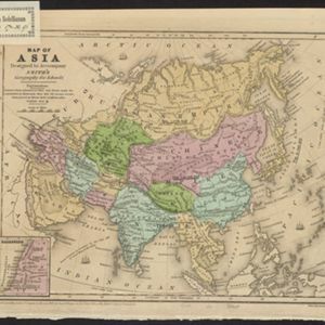
Map of Asia, marked with populations of cities and lengths of rivers. Mainland Southeast Asia is divided into kingdoms, but maritime Southeast Asia is mostly blank, and parts such as Java and the Lesser Sunda Islands are left off entirely.

Asiatic archipelago

event1832

location_onVietnam, Myanmar, Papua New Guinea, Philippines, Singapore, Southeast Asia, Thailand, Malaysia, Laos, Indonesia, East Timor, Cambodia, Brunei

This late 19th century map of Southeast Asia shows the best maritime routes around the region, according to the time of year. There is also an inset map highlighting the rivers and southern islands of Singapore.

close