Search Results
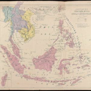
A language map of Further India and the Indian Archipelago
1878
Southeast Asia, Brunei, East Timor, Indonesia, Malaysia, Philippines, Singapore, Thailand, Vietnam, Myanmar, Laos, Cambodia
A map of Southeast Asia coloured to indicate the five different language families spoken in the region in the late 19th century. Names of indigenous tribes/languages are marked in red text, with European colonial possessions in grey.
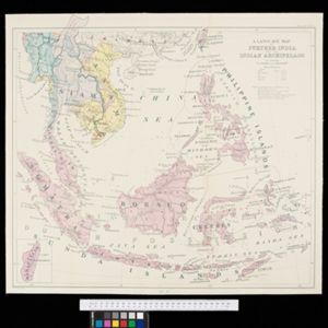
A language map of Further India and the Indian Archipelago
1878
Brunei, Cambodia, East Timor, Indonesia, Laos, Malaysia, Myanmar, Philippines, Singapore, Southeast Asia, Thailand, Vietnam
A map of Southeast Asia coloured to indicate the five different language families spoken in the region in the late 19th century. Names of indigenous tribes/languages are marked in red text, with European colonial possessions in grey.

The continent and islands of Asia: with all the latest discoveries
1839
Brunei, Cambodia, East Timor, Indonesia, Laos, Malaysia, Myanmar, Papua New Guinea, Singapore, Philippines, Southeast Asia, Thailand, Vietnam
On this map of Asia, the South China Sea is labelled ‘Malayan Sea’. Small islands, shoals and reefs are shown. A label in Cochin China (Vietnam) reads ‘mountains inhabited by the uncivilized people called Kemoys’.
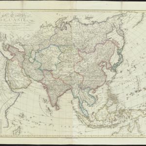
Carte generale de l'Asie: où se trouvent les découvertes faites par Bougainville, Dampier et La Pérouse
1833
Brunei, Cambodia, East Timor, Indonesia, Laos, Malaysia, Myanmar, Papua New Guinea, Philippines, Singapore, Southeast Asia, Thailand, Vietnam
This map of Asia is marked with the routes taken through Southeast Asia by the British Royal Navy captain James Cook, and the French explorer Lapérouse. The title also refers to two other explorers: Louis Antoine de Bougainville and William Dampier.

The continent and islands of Asia: with all the latest discoveries
1809
Vietnam, Myanmar, Papua New Guinea, Philippines, Singapore, Southeast Asia, Thailand, Malaysia, Laos, Indonesia, East Timor, Cambodia, Brunei
Southeast Asia is on the last sheet of this map of Asia. The South China Sea is labelled ‘Malayan Sea’. Small islands, shoals and reefs are shown. A label in Cochin China (Vietnam) reads ‘mountains inhabited by the uncivilized people called Kemoys’.
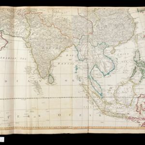
Asia and its islands according to D'Anville
1799
Brunei, Cambodia, East Timor, Indonesia, Laos, Malaysia, Myanmar, Papua New Guinea, Philippines, Singapore, Southeast Asia, Thailand, Vietnam
This late 18th century map features a number of labels describing the local populations, including the Kemoys ('Savage People') of the mountains of Cokin China (Vietnam), the Biayos of Borneo, and the 'Wild People' of the mountains of Pegu (Myanmar).
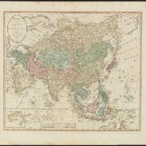
Bowles's new one-sheet map of Asia, divided into its empires, kingdoms, states, and other subdivisions
1795
Brunei, Cambodia, East Timor, Indonesia, Laos, Malaysia, Myanmar, Papua New Guinea, Philippines, Singapore, Southeast Asia, Thailand, Vietnam
A late 18th century map of Asia published in London by John Bowles, with regions indicated by colour. Central Borneo is labelled ‘Part inhabited by the Biayos’, which is seen on many contemporary maps, often with the comment ‘a savage people’.
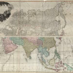
Asia and its islands according to D'Anville: divided into empires, kingdoms, states, regions, &ca.
1794
Brunei, Cambodia, Indonesia, East Timor, Laos, Malaysia, Myanmar, Papua New Guinea, Philippines, Singapore, Thailand, Vietnam, Southeast Asia
This late 18th century map features a number of labels describing the local populations, including the Kemoys ('Savage People') of the mountains of Cokin China (Vietnam), the Biayos of Borneo, and the 'Wild People' of the mountains of Pegu (Myanmar).
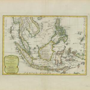
The East India Islands: comprehending the Isles of Sunda, the Moluccas and the Philippine Islands
1789
Brunei, Cambodia, East Timor, Indonesia, Laos, Malaysia, Myanmar, Philippines, Singapore, Southeast Asia, Thailand, Vietnam
Labels on this late 18th century map of Southeast Asia describe two indigenous populations—the ‘Kemoy’ of the mountains along the border of Cochin China (Vietnam) and Camboja (Cambodia), and the ‘Biayos’ of central Borneo—as ‘a wild Nation’.
- Filter from 1683 to 1890
- [remove]Sunda Islands51
- Borneo47
- Sumatra46
- Sulawesi43
- Java41
- Maluku Islands36
- Malay Peninsula32
- Celebes29
- Western New Guinea29
- Gulf of Thailand18
- Nova Guinea14
- Isles of Sunda13
- more Detailed Location »
- [remove]Race/Ethnicity51
- Religious Groups18
- Languages Spoken2

