Search

Search Results

Nuove carte delle Isole di Sunda come Borneo, Sumatra e Java Grande &c.

event1740

location_onBrunei, Cambodia, Indonesia, Malaysia, Singapore, Thailand

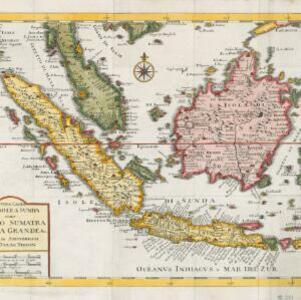
Based on a Dutch map of the Sunda Islands, with the text changed to Italian. Some Dutch remains e.g. a label on Borneo: ‘Beajous Afgoden dienars bewonende het middelste gedeelte vant Eilland [Beajous idolaters inhabit the middle part of the Island]’.

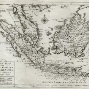
Nuove carte delle Isole di Sunda come Borneo, Sumatra e Java Grande &c.

eventc.1740-1784

location_onBrunei, Cambodia, Indonesia, Malaysia, Singapore, Thailand

Based on a Dutch map of the Sunda Islands, with the text changed to Italian. Some Dutch remains e.g. a label on Borneo: ‘Beajous Afgoden dienars bewonende het middelste gedeelte vant Eilland [Beajous idolaters inhabit the middle part of the Island]’.
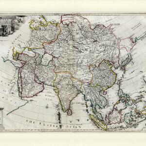
Asia corrected from the observation communicated to the Royal Society at London and the Royal Academy at Paris

event1713

location_onBrunei, Cambodia, East Timor, Indonesia, Laos, Malaysia, Myanmar, Philippines, Singapore, Southeast Asia, Thailand, Vietnam

This early 18th century map of Asia features a drawing of a woman burning offerings on an altar, while two children carry cornucopias, and a camel looks on. The Roman god Mercury descends from the sky in the background wearing his winged helmet.

Asia: according to ye newest observations

event1713

location_onBrunei, Cambodia, East Timor, Indonesia, Laos, Malaysia, Myanmar, Philippines, Singapore, Southeast Asia, Thailand, Vietnam

This early 18th century map of Asia features a drawing of a woman burning offerings on an altar, while two children carry cornucopias, and a camel looks on. The Roman god Mercury descends from the sky in the background wearing his winged helmet.

Isole di Banda nelle Molucche

event1692

location_onIndonesia

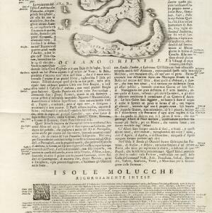
Map of the Banda Islands from Vicenzo Coronelli's ‘Corso Geografico Universale’, including a volcano on Gunappi (Banda Api), and a military fort on Nera (Banda Neira). Italian text describes the crops, trade, animals and people of the Maluku Islands.

The isles of Sonda

event1680

location_onBrunei, Indonesia, Malaysia, Singapore

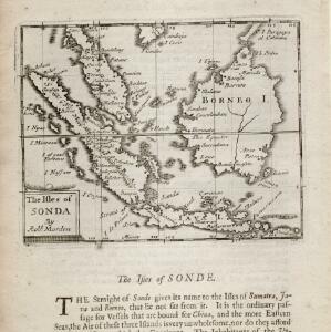
From Robert Morden’s ‘Geography Rectified’, a description with maps of the known world in the late 17th century. Text describes the peoples of the uplands of the Sunda Islands as ‘Pagans’, while the coastal peoples are ‘Mahumetans [Muslims]’.

India quae Orientalis dicitur, et insvlae adiacentes

event1664

location_onBrunei, Cambodia, East Timor, Indonesia, Laos, Malaysia, Myanmar, Philippines, Singapore, Southeast Asia, Thailand, Vietnam

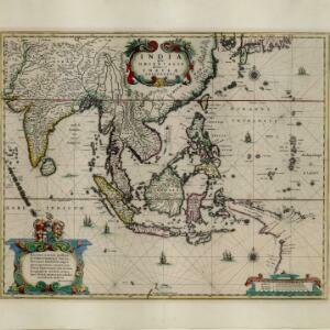
French text on the reverse of this map describes the religion, languages, crops, trade etc. of Aracam and Pegu (Myanmar), Siam (Thailand), Cambaja (Cambodia). The map is dedicated to the Dutch merchant Christophoro Thisio.

Molvccae insvlae celeberrimae

eventc.1640-1655

location_onIndonesia

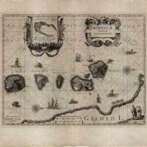
This small island chain off the west coast of Gilolo (Halmahera in the Maluku Islands, Indonesia), was an important area for the spice trade. Latin text on the reverse describes the trade/islands. North is located to the right, rather than the top.

Insulæ Indiæ orientalis præcipuæ: in quibus Moluccæ celeberrimæ sunt

event1623

location_onBrunei, Cambodia, East Timor, Indonesia, Laos, Malaysia, Myanmar, Philippines, Singapore, Southeast Asia, Thailand, Vietnam

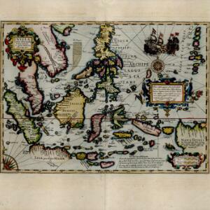
On the right of this map, Latin text held within an elaborate border notes that five of the Maluku Islands are located nearby—Ternate, Tidore, Moti, Makian and Bacan—which trade spices including clove, cinnamon, nutmeg and ginger to the world.

Moluccæ insulæ

event1618

location_onIndonesia, East Timor

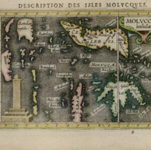
Unusually, north is located to the right of this early 17th century map of the Maluku Islands, rather than the top. The scale is shown on a stone monument. French text on the reverse describes Java.

Insulæ Indiæ orientalis præcipuæ: in quibus Moluccæ celeberrimæ sunt

event1606

location_onBrunei, Cambodia, East Timor, Indonesia, Laos, Malaysia, Myanmar, Philippines, Singapore, Southeast Asia, Thailand, Vietnam

On the right of this map, Latin text held within an elaborate border notes that five of the Maluku Islands are located nearby—Ternate, Tidore, Moti, Makian and Bacan—which trade spices including clove, cinnamon, nutmeg and ginger to the world.

Svmatra cum circumiacentibus insulis

event1601

location_onIndonesia, Malaysia, Singapore

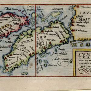
A colourful early 17th century map of Sumatra, Java and the Malay Peninsula, with North located to the left, and major settlements marked. Latin text on the reverse describes the peoples, religions, languages, agriculture, mining etc. of the region.

close

  • Filter from 1544 to 1740

Current results range from 1544 to 1740