Search

Search Results

Atlas van Nederlandsch Oost-Indië

eventc.1897-1904

location_onIndonesia

Very detailed atlas of the entire Dutch East Indies, over 16 map sheets, with a cover and overview map. Includes topographic maps, inset maps of cities and islands, and maps featuring land and sea routes, languages, geology, colonial territory etc.

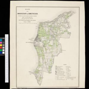
Kaart van Makassar en Omstreken

event1894

location_onIndonesia

Map of the city of Makassar, Celebes (Suawesi), with the Dutch Fort Rotterdam, Koning’s Plein (King's Square) and a military hospital. The surrounding area has villages and crops: rice (paddy) fields, coconut, bamboo, nipa palm, banana.

Kaart van den Nederlandsch-Indischen Archipel

event1890

location_onIndonesia, East Timor, Brunei, Cambodia, Malaysia, Philippines, Singapore, Southeast Asia, Thailand, Vietnam

The seas of the Dutch East Indies are the focus of this map, with maritime routes, sea temperature, sea depth, currents and monsoons shown. There are graphs of population by ethnicity, agriculture and livestock, trade and shipping, and trade exports.

Kaart van Zuid Celebes met uitzondering van het rijk Gowa

event1890

location_onIndonesia

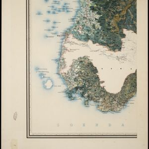
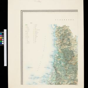
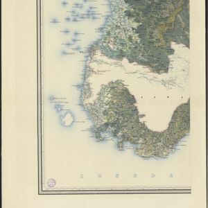
Detailed topographical map of South Celebes (Sulawesi) spread over four sheets, featuring crops (coffee, alang-alang, rice), fishing ponds, salt panning. With two additional maps of the island of Saleijer (Selayar) and Pitoempanoewae (Pitumpanua).

Kaart van zuid Celebes mit uitzondering van het rijk Gowa

event1888

location_onIndonesia

Map of the South Peninsula of Celebes (Sulawesi), spread over four sheets. It features crops (alang-alang, coffee, rice, sugarcane), fishing ponds, salt panning, routes, mountains, forests and settlements. The Gowa Regency is left blank.

Kaart van Zuid Celebes met uitzondering van het Rijk Gowa

event1886

location_onIndonesia

Map of the South Peninsula of Celebes (Sulawesi), spread over four sheets. It features crops (alang-alang, coffee, rice, sugarcane), fishing ponds, salt panning, routes, mountains, forests and settlements. The Gowa Regency is left blank.

Kaart van den Indischen Archipel aangevende den bestaanden toestand met betrekking tot de Gouvernements Monopoliën van Opium en Zout

event1882

location_onIndonesia

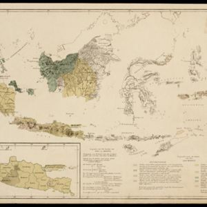
Different levels of government monopolies are indicated on this map of the Dutch East Indies by the use of areas of colour (opium trade) and hash marks (salt trade). The inset map of Java is divided into residencies.

Nederlandsch Oost-Indië

event1865

location_onBrunei, Cambodia, East Timor, Indonesia, Laos, Malaysia, Myanmar, Vietnam, Thailand, Southeast Asia, Singapore, Philippines, Papua New Guinea

This detailed map of the Dutch East Indies in the mid-19th century contains a great deal of information: topographical details, settlements and administrative areas, roads, railways and maritime routes, telegraph lines, inset maps etc.

Algemeene Atlas van Nederlandsche Indie

eventc.1853-1862

location_onIndonesia

Atlas featuring over 60 detailed maps of the Dutch East Indies: 24 maps cover Java; the remainder cover the rest of the Dutch East Indies. There are three index maps. (All the maps in this atlas are also presented separately on this platform.)

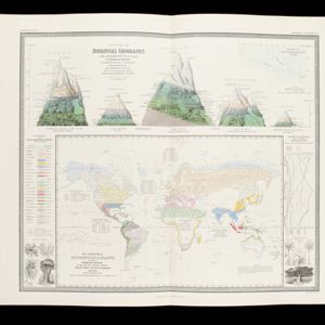
The geographical distribution of plants according to Humboldt's statistics of the principal families and groups: Schouw's twenty five phyto-geographic regions, and the distribution of the family of palms and the genera Pinus (pine) & Erica (heath)

event1849

location_onBrunei, Cambodia, East Timor, Indonesia, Laos, Malaysia, Myanmar, Papua New Guinea, Philippines, Singapore, Southeast Asia, Thailand, Vietnam

World map showing the distribution of plants, including in Southeast Asia (e.g. Areca catechu (betel tree), Calamus, Caryota urens, Altingia, Pinus Dammara (Amboina pine), P. sinensis). With data on plant growth in different temperature zones.

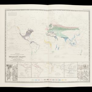
Survey of the geographical distribution and cultivation of the most important plants which are used as food for man: with indications of the isotheres & isochimenes, or lines of equal summer & winter temperature

event1849

location_onBrunei, Cambodia, East Timor, Indonesia, Laos, Malaysia, Myanmar, Papua New Guinea, Philippines, Singapore, Southeast Asia, Thailand, Vietnam

Map of important food crops (rice in Southeast Asia). Inset maps of tea, cassia, pepper, cinnamon, clove, nutmeg, sugar, coffee. With isothermal lines—lines joining locations of same temperature—of summer and winter temperatures, and plant drawings.

Algemeene Kaart van Nederlandsch Oostindie

event1842

location_onEast Timor, Indonesia, Malaysia, Singapore

This detailed map of the Dutch East Indies in the mid-19th century is spread over eight sheets, plus a cover sheet showing the whole area. There are numerous inset maps of islands, bays, cities etc.

close