Search

Search Results

Map of the Kingdom of Siam and its dependencies

eventc.1900

location_onMyanmar, Malaysia, Singapore, Thailand, Laos, Cambodia, Vietnam

The border of the Kingdom of Siam (Thailand) and its internal administrative districts are highlighted in yellow. Inset maps show the cities of Bangkok, Chiengmai (Chiang Mai) and Luang Pra Bang (Luang Prabang) in more detail.

Burma with parts of India, China and Siam

event1888

location_onMyanmar, Laos, Thailand

Map of Burma used as advertising by a clothing shop in Rangoon (Yangon, Myanmar). There is a calendar with each day marked with an historic event. The map is labelled with indigenous peoples (uppercase red text) and products of each area.

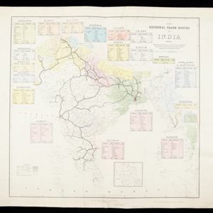
The external trade routes of India: with tables showing the amount and value of the principal exports and imports of the chief Indian sea ports and frontier states

event1886

location_onMyanmar, Thailand

This map of the trade routes of India includes Burma (Myanmar) and part of Siam (Thailand). The Rangoon and Irrawaddy Valley State Railway is marked. There are tables showing the values of imports and exports for each area, listed by produce type.

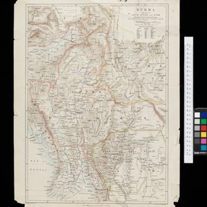
Burma: with parts of India, China, and Siam

event1886

location_onMyanmar, Laos, Thailand

Map of Burma labelled with indigenous peoples (uppercase red text) and products (salt, copper, tea, rubies, coal, rubber, petroleum, marble, jade, silver) of each area. It also marks two journeys by the explorer J. Annan Bryce, and proposed railways.

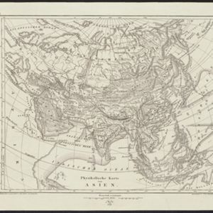
Physikalische Karte von Asien

event1881

location_onBrunei, Cambodia, East Timor, Indonesia, Laos, Malaysia, Myanmar, Philippines, Singapore, Southeast Asia, Thailand, Vietnam

Crops are marked on this map of Asia: Sumatra and Java have sugar, coffee, tea; the Lesser Sunda Islands and Maluku Islands have cinnamon, nutmeg and clove; mainland Southeast Asia has sugar and cotton. Arrows on the sea indicate currents.

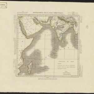
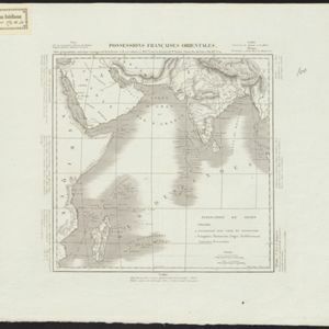
Possessions Françaises orientales

eventc.1845

location_onMyanmar

Although this map focuses on French colonial possessions in Africa, the Arabian Peninsula and India, a small part of Southeast Asia is shown: labelled ‘Birmans’, it was part of the Birman Empire (modern Myanmar).

Possessions Françaises orientales

eventc.1845

location_onMyanmar

Although this map focuses on French colonial possessions in Africa, the Arabian Peninsula and India, a small part of Southeast Asia is shown: labelled ‘Birmans’, it was part of the Birman Empire (modern Myanmar).

Possessions Françaises orientales

eventc.1845

location_onMyanmar

Although this map focuses on French colonial possessions in Africa, the Arabian Peninsula and India, a small part of Southeast Asia is shown: labelled ‘Birmans’, it was part of the Birman Empire (modern Myanmar).

Possessions Françaises orientales

eventc.1845

location_onMyanmar

Although this map focuses on French colonial possessions in Africa, the Arabian Peninsula and India, a small part of Southeast Asia is shown: labelled ‘Birmans’, it was part of the Birman Empire (modern Myanmar).

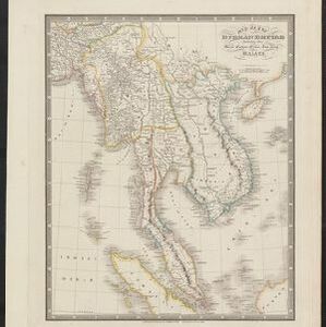
Map of the Burman Empire including also Siam, Cochin-China, Ton-king and Malaya

event1842

location_onVietnam, Malaysia, Myanmar, Cambodia, Thailand, Laos, Indonesia, Singapore, Brunei

Although this mid-19th century map covers all of mainland Southeast Asia, the Burman Empire (Myanmar) is shown in greater detail, especially its districts, rivers and place names. It was produced by the James Wyld, geographer to Queen Victoria.

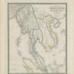
Map of the Burman Empire including also Siam, Cochin-China, Ton-king and Malaya

event1842

location_onVietnam, Myanmar, Malaysia, Indonesia, Thailand, Laos, Cambodia, Brunei, Singapore

Regional borders are colour-coded on this mid-19th century map of mainland Southeast Asia, with British colonial territory in red (including part of the Burman Empire, the Straits Settlements, and Sarawak on Borneo).

close