Map of the Banda Islands from Vicenzo Coronelli's ‘Corso Geografico Universale’, including a volcano on Gunappi (Banda Api), and a military fort on Nera (Banda Neira). Italian text describes the crops, trade, animals and people of the Maluku Islands.
Sumatra
event1565
location_onIndonesia
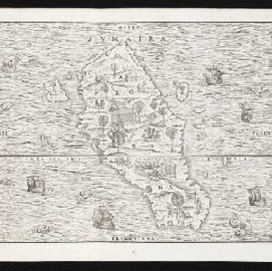
This early map of Sumatra (labelled ‘Taprobana’) features many illustrations. In the sea, there are ships, fish and sea monsters, while on land, plantations, agricultural workers, a shepherd and wooden buildings highlight the economy of the island.
Sumatra
event1565
location_onIndonesia
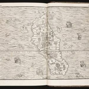
This early map of Sumatra (labelled ‘Taprobana’) features many illustrations. In the sea, there are ships, fish and sea monsters, while on land, plantations, agricultural workers, a shepherd and wooden buildings highlight the economy of the island.
Sumatra
event1565
location_onIndonesia
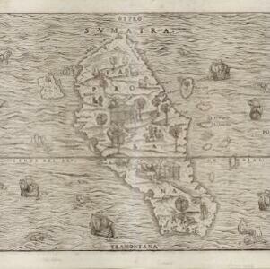
This early map of Sumatra (labelled ‘Taprobana’) features many illustrations. In the sea, there are ships, fish and sea monsters, while on land, plantations, agricultural workers, a shepherd and wooden buildings highlight the economy of the island.
Sumatra
event1565
location_onIndonesia
This early map of Sumatra (labelled ‘Taprobana’) features many illustrations. In the sea, there are ships, fish and sea monsters, while on land, plantations, agricultural workers, a shepherd and wooden buildings highlight the economy of the island.