Search Results

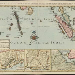
Partie de la nouvelle Grande Cartes des Indes Orientales, contenant les Isles Maldives, Ceylan, Malacca, Sumatra &c.
1700
Indonesia, Malaysia, Singapore, Thailand
Sumatra and the Malay Peninsula feature on this map of the Indian Ocean. Enganno Island, west of southern Sumatra, has a label that translates as ‘inhabited by very pernicious savages’. An inset map depicts the Madura Strait between Java and Madura.
- Filter from 1700 to 1898
- [remove]Canal2
- River2
- Railway/Tramway1
- Road1
- [remove]National Border2
- Colonial Possessions1
- District/Administrative Border1
- Regional Border1


