Search

Search Results

Isole di Banda nelle Molucche

event1692

location_onIndonesia

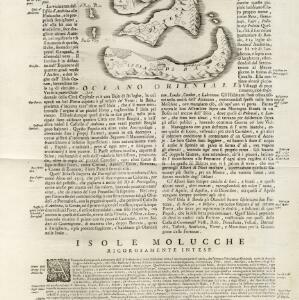
Map of the Banda Islands from Vicenzo Coronelli's ‘Corso Geografico Universale’, including a volcano on Gunappi (Banda Api), and a military fort on Nera (Banda Neira). Italian text describes the crops, trade, animals and people of the Maluku Islands.

Sumatra

event1565

location_onIndonesia

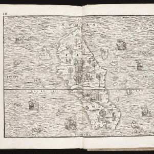
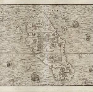
This early map of Sumatra (labelled ‘Taprobana’) features many illustrations. In the sea, there are ships, fish and sea monsters, while on land, plantations, agricultural workers, a shepherd and wooden buildings highlight the economy of the island.

Sumatra

event1565

location_onIndonesia

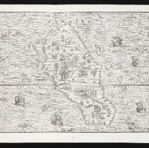
This early map of Sumatra (labelled ‘Taprobana’) features many illustrations. In the sea, there are ships, fish and sea monsters, while on land, plantations, agricultural workers, a shepherd and wooden buildings highlight the economy of the island.

Sumatra

event1565

location_onIndonesia

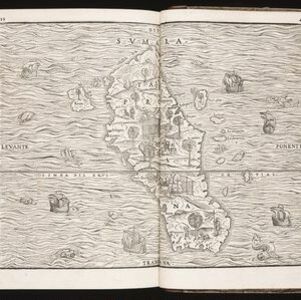
This early map of Sumatra (labelled ‘Taprobana’) features many illustrations. In the sea, there are ships, fish and sea monsters, while on land, plantations, agricultural workers, a shepherd and wooden buildings highlight the economy of the island.

Sumatra

event1565

location_onIndonesia

This early map of Sumatra (labelled ‘Taprobana’) features many illustrations. In the sea, there are ships, fish and sea monsters, while on land, plantations, agricultural workers, a shepherd and wooden buildings highlight the economy of the island.

[Java Minor and map of Necumera, Locaz, Patera, Botegon, Mangama]

event1547

location_onThailand, Indonesia

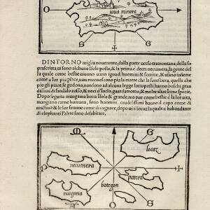
Taken from Benedetto Bordone's ‘Isolario [The Book of Islands]’, these pages contain two maps: one of Sumatra (‘Iaua Minore’), and one of a group of five unknown islands (Locaz is thought to possibly be Thailand).

close

  • Filter from 1547 to 1692

Current results range from 1547 to 1692