Search

Search Results

Stanford's Library Map of Asia

event1899

location_onBrunei, Cambodia, East Timor, Indonesia, Laos, Malaysia, Myanmar, Philippines, Singapore, Southeast Asia, Thailand, Vietnam

Southeast Asia is on sheet four of this map. British colonial territory—British Burma, the Straits Settlements, Sarawak, Brunei, British North Borneo—is highlighted in red, with Dutch, Spanish, French and Portuguese territory also shown.

Route chart to India and the East

event1895

location_onBrunei, Cambodia, East Timor, Indonesia, Laos, Malaysia, Myanmar, Philippines, Singapore, Southeast Asia, Thailand, Vietnam

Map of Asia featuring steamship routes—including around Southeast Asia—connecting ports such as Penang, Singapore, Batavia (Jakarta), Saigon, Bangkok, Rangun (Yangon), Manila, Macassar (Makassar) etc. There is also an inset map of Singapore.

Stanford's Library Map of Asia

event1891

location_onBrunei, Cambodia, East Timor, Indonesia, Laos, Malaysia, Myanmar, Philippines, Singapore, Southeast Asia, Thailand, Vietnam

Southeast Asia is on sheet four of this map. British colonial territory—British Burma, the Straits Settlements, Sarawak, British North Borneo—is highlighted in red, with the Dutch East Indies, Spanish Philippines and Portuguese East Timor also shown.

Malay, or East Indian Archipelago, with Burmah, Siam &c.

event1887

location_onBrunei, Cambodia, East Timor, Indonesia, Laos, Malaysia, Myanmar, Philippines, Singapore, Southeast Asia, Thailand, Vietnam

On this map of Southeast Asia, numerous small islands, shoals and reefs are marked and named, especially in the South China Sea and around the Sunda and Maluku islands. Submarine cables to carry telegraph messages around the region are also shown.

Stanford's library map of Asia

event1862

location_onBrunei, Cambodia, East Timor, Indonesia, Laos, Myanmar, Malaysia, Philippines, Singapore, Southeast Asia, Thailand, Vietnam

Map of Asia on four sheets, with Southeast Asia on sheet four. British colonial territory—British Burma, the Straits Settlements, Sarawak—is highlighted in red, with the Dutch East Indies, Spanish Philippines and Portuguese East Timor also shown.

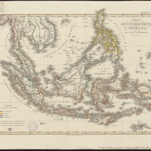
Die Ostindischen Inseln

event1846

location_onBrunei, Cambodia, East Timor, Indonesia, Laos, Malaysia, Myanmar, Philippines, Singapore, Southeast Asia, Thailand, Vietnam

Map of Southeast Asia highlighting the colonial possessions of the Netherlands (Dutch East Indies), Spain (Philippines), Britain (Straits Settlements, Burma, part of Borneo) and Portugal (East Timor). From the German atlas ‘Stielers Handatlas’.

Algemeene Kaart van Nederlandsch Oostindie

event1842

location_onEast Timor, Indonesia, Malaysia, Singapore

This detailed map of the Dutch East Indies in the mid-19th century is spread over eight sheets, plus a cover sheet showing the whole area. There are numerous inset maps of islands, bays, cities etc.

East India Islands

event1840

location_onVietnam, Myanmar, Papua New Guinea, Philippines, Singapore, Southeast Asia, Thailand, Malaysia, Laos, Indonesia, East Timor, Cambodia, Brunei

The colonial possessions of Britain (in red, though faded on this map), the Netherlands (green, but discoloured to blue) and Spain (the Philippines, brown) are shown on this map, with independent areas such as Borneo and the Maluku Islands in yellow.

Algemeene kaart van Nederlandsch Oostindie

eventc.1839-1855

location_onEast Timor, Indonesia, Malaysia, Singapore

This map of the Dutch East Indies is spread over eight sheets, with a hand-drawn cover sheet showing the whole area. There are numerous inset maps of islands, bays, cities etc. Two of the inset maps have a replacement map pasted over them.

close