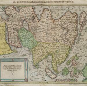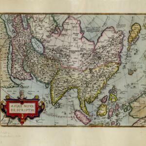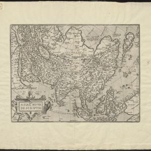
Asiae nova descriptio
1570
Brunei, Cambodia, East Timor, Indonesia, Laos, Malaysia, Myanmar, Philippines, Singapore, Southeast Asia, Thailand, Vietnam
Map of Asia featuring mythical lakes that were once thought to exist in southern China—including ‘Caÿamaÿ Lacus’—and which feed several rivers that flow south through mainland Southeast Asia. Carvings of people and animals decorate the cartouche.