Search

Search Results

Map of the Kingdom of Siam and its dependencies

eventc.1900

location_onMyanmar, Malaysia, Singapore, Thailand, Laos, Cambodia, Vietnam

The border of the Kingdom of Siam (Thailand) and its internal administrative districts are highlighted in yellow. Inset maps show the cities of Bangkok, Chiengmai (Chiang Mai) and Luang Pra Bang (Luang Prabang) in more detail.

Plan of the town and suburbs of Rangoon

eventc.1895-1897

location_onMyanmar

Detailed plan of the city of Rangoon (Yangon, Myanmar) with commercial, religious, government and military buildings, surrounded by lakes, fields of crops and villages. Someone has drawn details on the map of areas that have undergone ‘levelling’.

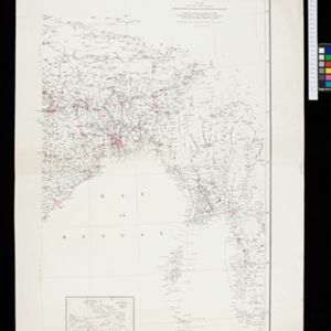
India showing missionary stations

event1884

location_onMyanmar, Thailand, Malaysia, Singapore, Indonesia

This two-sheet map of India and Burma (Myanmar) shows missionary stations. The legend lists 29 European and 13 American missionary societies and churches, each with their own symbol to show their location on the map.

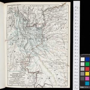
Übersichtskarte der Französischen Expedition in Hinterindien vom Me-khong bis zum Jang-tse-kiang

event1869

location_onMyanmar, Thailand, Vietnam, Laos

This map of the border region between China, Birma (Myanmar), Siam (Thailand and Laos) and Anam (Vietnam) is marked with the routes of five expeditions of the region from 1837 to 1868. Locations of Roman Catholic missionaries are also shown.

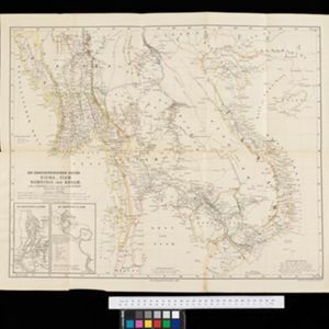
Der Indochinesischen Reiche: Birma, Siam, Kambodja und Annam

event1867

location_onCambodia, Laos, Malaysia, Myanmar, Thailand, Vietnam

The route between Saigon and Rangoon taken by the German ethnologist Adolf Bastian is marked on this map of mainland Southeast Asia. There are two inset maps of cites: Mandalay, Amarapura and Ava in Burma; and Bangkok in Siam (including 14 temples).

Military cantonments: town and suburbs of Akyab, 1853-54

event1866

location_onMyanmar

Plan of British military installations in the port town of Akyab, Burma (Sittwe, Myanmar), featuring piers on the Kolladyne River (Kaladan River), hospitals, a work house, mission house, hotel, bazaar, burial grounds, religious buildings etc.

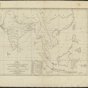
A Map Illustrative of the Baptist Missionary Stations

event1815

location_onBrunei, Cambodia, East Timor, Indonesia, Laos, Malaysia, Myanmar, Philippines, Singapore, Southeast Asia, Thailand, Vietnam

This map marks the locations of Baptist missionary stations in Asia, including at Ava, Rangoon, Java and Amboyna (Ambon) in Southeast Asia. The station at Java also has a school. The map’s legend lists the stations’ dates of foundation.

A map of the East-Indies and the adjacent countries: with the settlements, factories and territories, explaning what belongs to England, Spain, France, Holland, Denmark, Portugal &c.

eventc.1720

location_onBrunei, Cambodia, East Timor, Indonesia, Laos, Malaysia, Myanmar, Philippines, Singapore, Southeast Asia, Thailand, Vietnam

This map showcases the colonial territories of Southeast Asia in the 18th century, with text detailing trading information and the products of each region. There are five inset maps featuring plans of specific trading ports.

A map of the East-Indies and the adjacent countries: with the settlements, factories and territories, explaning what belongs to England, Spain, France, Holland, Denmark, Portugal &c.

event1720

location_onBrunei, Cambodia, East Timor, Indonesia, Laos, Malaysia, Myanmar, Philippines, Vietnam, Thailand, Southeast Asia, Singapore

This map showcases the colonial territories of Southeast Asia in the 18th century, with text detailing trading information and the products of each region. There are five inset maps featuring plans of specific trading ports.

A map of the East-Indies and the adjacent countries: with the settlements, factories and territories, explaining what belongs to England, Spain, France, Holland, Denmark, Portugal &c.

event1717

location_onBrunei, Cambodia, East Timor, Indonesia, Laos, Malaysia, Myanmar, Philippines, Singapore, Southeast Asia, Thailand, Vietnam

This map showcases the colonial territories of Southeast Asia in the 18th century, with text detailing trading information and the products of each region. There are five inset maps featuring plans of specific trading ports.

close