
Search Results


China
1898
Brunei, Cambodia, East Timor, Indonesia, Laos, Malaysia, Myanmar, Philippines, Singapore, Southeast Asia, Thailand, Vietnam
This map highlights the colonisation of Southeast Asia, showing French Indochina (green), British Burma and Malaya (orange), the Dutch East Indies (pink), and the Spanish Philippines (green). In the region, only Siam (yellow) is independent.

Sketch map of China and adjoining regions: showing the density of population, mineral resources, chief products, principal trade routes, existing and projected railways, and inland navigation
1898
Myanmar, Thailand, Vietnam
This map of China features a small part of northeastern Southeast Asia. Population density is shown, along with rivers, trade routes, tidal river navigation limits, railways (existing and suggested), and two coal mines in Tong-King (Vietnam).


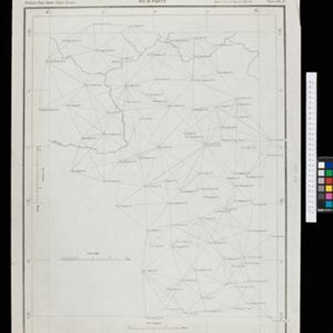
Burma and adjacent countries: With additions and corrections to boundaries and railways up to December, 1898
1898
Myanmar, Thailand
The regional and national borders of Burma and Siam are hand-coloured on this map. Provinces, districts and states within Burma are also highlighted, and itemised in a separate list.
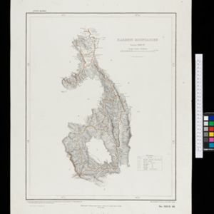

Burma with parts of India, China and Siam
1888
Myanmar, Laos, Thailand
Map of Burma used as advertising by a clothing shop in Rangoon (Yangon, Myanmar). There is a calendar with each day marked with an historic event. The map is labelled with indigenous peoples (uppercase red text) and products of each area.


Soematra, Bangka en de Riouw-Lingga Archipel
1897
Malaysia, Indonesia, Singapore, Myanmar
Map of Sumatra and surrounding islands, with residencies—administrative districts—shown by coloured borders. There are inset maps of two residencies surrounding Padang, and of Groot-Atjeh (Aceh). Rivers, railways, roads and settlements are marked.
- Filter from 1478 to 1900
- English248
- Latin183
- French171
- German76
- Dutch67
- Italian18
- Hindi1
- Portuguese1
- more Language »
- [remove]Myanmar715
- Thailand645
- Malaysia598
- Cambodia594
- Vietnam594
- Laos589
- Indonesia573
- Singapore556
- Brunei525
- Philippines518
- Southeast Asia502
- East Timor466
- more Simple Location »
- Sumatra551
- Borneo506
- Java461
- Malay Peninsula439
- Sulawesi405
- Celebes342
- Siam336
- Western New Guinea291
- Maluku Islands274
- Pegu254
- Sunda Islands214
- Malacca204
- more Detailed Location »


