
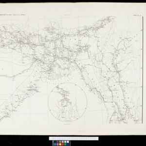
Search Results


Stanford's Map of the Empires of China & Japan with the adjacent parts of the Russian Empire, India, Burma &c.
1895
Myanmar, Vietnam
The most northern part of Southeast Asia is shown on this map of China and Japan, with Burma (Myanmar) and Tong King (Vietnam) appearing at the bottom of the map. Mountains, rivers and settlements are marked, as well as a railway line in Burma.


Plan of the town and suburbs of Rangoon
c.1895-1897
Myanmar
Detailed plan of the city of Rangoon (Yangon, Myanmar) with commercial, religious, government and military buildings, surrounded by lakes, fields of crops and villages. Someone has drawn details on the map of areas that have undergone ‘levelling’.

The chief passes from Siam into Tavoi / The Siamese Malay States
1895
Myanmar, Thailand, Malaysia
Two maps of Siam (Thailand). The larger map shows routes through mountain passes from Siam to the city of Tavoi (Dawei, on the west coast of Myanmar). The smaller map is marked with trade routes around Lower Siam (Southern Thailand).


Map to illustrate Convention of March 1st 1894 between Great Britain and China: From the Map of Upper Burma
1894
Myanmar
Map of the border region between the Shan States of northeast Burma (Myanmar) and China's Yunnan Province, illustrating the result of the 1894 Sino-British boundary convention. The Burma side is more detailed, with mountains, rivers and settlements.


- Filter from 1478 to 1900
- English248
- Latin183
- French171
- German76
- Dutch67
- Italian18
- Hindi1
- Portuguese1
- more Language »
- [remove]Myanmar715
- Thailand645
- Malaysia598
- Cambodia594
- Vietnam594
- Laos589
- Indonesia573
- Singapore556
- Brunei525
- Philippines518
- Southeast Asia502
- East Timor466
- more Simple Location »
- Sumatra551
- Borneo506
- Java461
- Malay Peninsula439
- Sulawesi405
- Celebes342
- Siam336
- Western New Guinea291
- Maluku Islands274
- Pegu254
- Sunda Islands214
- Malacca204
- more Detailed Location »


