Search Results

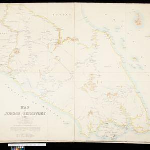
Map of Johore Territory 1893
1893
Malaysia, Singapore
Map of the Malay state of Johor, and Singapore. The route of a proposed railway north from Johor Bahru is shown. Apart from rivers and mountains, much of the terrain is blank, with labels such as ‘Unexplored Hill Country’ or ‘Dense Jungle and Swamp’.

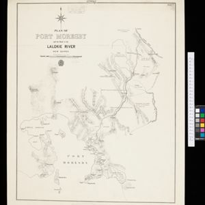
Plan of Port Moresby and the road to the Lolokie River: New Giunea
1887
Papua New Guinea
This map focuses on the capital city of British New Guinea, Port Moresby, and the road heading north-east from the city to the Laloki River. Along the road, there are descriptions of the terrain (‘Open flat fairly grasses timbered with bastard Gum’).
- [remove]Intelligence Division, War Office4
- J.H. de Bussy1
- Stanford's Geographical Establishment1
- Surveyor General's Office, Brisbane1


