Search

Search Results

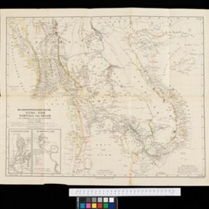
Der Indochinesischen Reiche: Birma, Siam, Kambodja und Annam

event1867

location_onCambodia, Laos, Malaysia, Myanmar, Thailand, Vietnam

The route between Saigon and Rangoon taken by the German ethnologist Adolf Bastian is marked on this map of mainland Southeast Asia. There are two inset maps of cites: Mandalay, Amarapura and Ava in Burma; and Bangkok in Siam (including 14 temples).

Plattegrond der stad Batavia

event1866

location_onIndonesia

A mid-19th century map of the important port of Batavia (Jakarta), with its pier, commercial centre and residential streets. However, the city is also surrounded by villages (kampongs), fields and plantations. An inset map shows Batavia Castle.

Nederlandsch Oost-Indië

event1865

location_onBrunei, Cambodia, East Timor, Indonesia, Laos, Malaysia, Myanmar, Vietnam, Thailand, Southeast Asia, Singapore, Philippines, Papua New Guinea

This detailed map of the Dutch East Indies in the mid-19th century contains a great deal of information: topographical details, settlements and administrative areas, roads, railways and maritime routes, telegraph lines, inset maps etc.

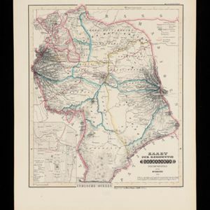
Kaart der Residentie Soerakarta

event1859

location_onIndonesia

Map of the Dutch colonial administrative region (residency) of Soerakarta (Surakarta, Java). Inset map of Surakarta city, with a military fort and two palaces. (From ‘Algemeene Atlas van Nederlandsche Indie [General Atlas of the Dutch East Indies]’.)

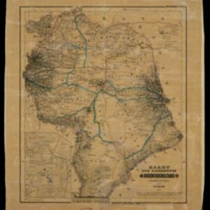
Kaart der residentie Soerakarta

event1859

location_onIndonesia

The residency of Soerakarta in Central Java is shown divided into regencies (yellow borders) and districts (blue borders). There is an inset plan of the capital city, Soerakarta (modern Surakarta), and mountains and land routes are marked.

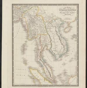
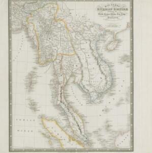
Map of the Burman Empire including also Siam, Cochin-China, Ton-king and Malaya

event1842

location_onVietnam, Malaysia, Myanmar, Cambodia, Thailand, Laos, Indonesia, Singapore, Brunei

Although this mid-19th century map covers all of mainland Southeast Asia, the Burman Empire (Myanmar) is shown in greater detail, especially its districts, rivers and place names. It was produced by the James Wyld, geographer to Queen Victoria.

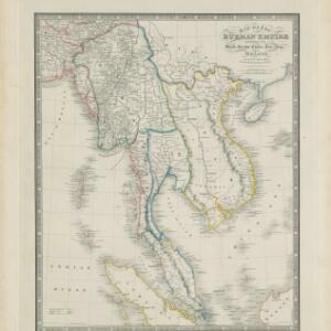
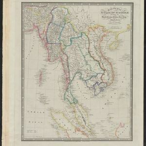
Map of the Burman Empire including also Siam, Cochin-China, Ton-king and Malaya

event1842

location_onVietnam, Myanmar, Malaysia, Indonesia, Thailand, Laos, Cambodia, Brunei, Singapore

Regional borders are colour-coded on this mid-19th century map of mainland Southeast Asia, with British colonial territory in red (including part of the Burman Empire, the Straits Settlements, and Sarawak on Borneo).

Kaart van de Nederlandsche bezittingen in Oost-Indië

event1840

location_onBrunei, East Timor, Indonesia, Malaysia, Philippines, Singapore

This map shows the Dutch colonial possessions in the East Indies in the mid-19th century. The text provides great detail about the people, religion, crops, animals, geography and administration of the Dutch East Indies.

Map of the Burman Empire including also Siam, Cochin-China, Ton-king and Malaya

eventc.1840-1852

location_onVietnam, Malaysia, Myanmar, Cambodia, Thailand, Laos, Singapore, Brunei

Although this mid-19th century map covers all of mainland Southeast Asia, the Burman Empire (Myanmar) is shown in greater detail, especially its districts, rivers and place names. It was produced by the James Wyld, geographer to Queen Victoria.

Map of the Burman Empire including also Siam, Cochin-China, Ton-king and Malaya

event1832

location_onVietnam, Myanmar, Malaysia, Indonesia, Thailand, Laos, Cambodia, Brunei, Singapore

Regional borders are colour-coded on this mid-19th century map of mainland Southeast Asia, with British colonial territory in red (including part of the Burman Empire, the Straits Settlements, and Sarawak on Borneo).

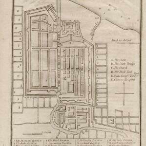
Batavia

event1812

location_onIndonesia

A plan of Batavia in the early 19th century, with the castle, church, dock yard, timber yard and hospital highlighted on the map’s legend. Also shown is the canal flowing through the city to the port, where the sea depth (‘soundings’) is indicated.

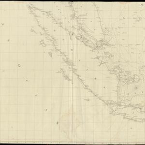
[Sumatra and the Strait of Malacca]

eventc.1800

location_onMalaysia, Singapore, Indonesia

Chart of maritime Southeast Asia, showing bathymetry (sea depth), islands, shoals, reefs, landmarks, and notes (‘Rock seen at Low Water’), all to aid navigation. A rhumbline network has been drawn on the map in pencil. Only one sheet is present.

close