Search

Search Results

Upper Burma

event1899

location_onMyanmar, Thailand

Map of Upper Burma, showing the borders with Assam (India), China and Siam (Thailand), as well as internal administrative borders. Mountains with their heights, settlements, rivers and railways (completed, proposed and under construction) are shown.

India shewing railways with stations

event1899

location_onMyanmar

This map focuses on India, but also includes Burma (Myanmar), showing the country’s railway lines with their stations, including engine changing stations and junction stations. Part of a series of maps charting the development of the railway system.

Skeleton map of India

event1899

location_onMyanmar

On this map of India, Burma (Myanmar) is divided into two regions: ‘British Burma’—under British colonial rule after the Second Anglo-Burmese War (1852)—and Upper Burma (labelled ‘Burma’), under British rule after the Third Anglo-Burmese War (1885).

Chart of triangulation: No.21 Party, Northern Shan States (Upper Burma)

event1899

location_onMyanmar

A triangulation map of part of Upper Burma (Myanmar), showing dozens of locations joined with straight lines to create a triangulation network.

Geologische skizze von Nord-Celebes

event1899

location_onIndonesia

Geological map of the Minahasa Peninsula, Celebes (Sulawesi) showing rock types. Two more topographical maps show the terrain of the northeast tip of the peninsula, with elevation views including of the volcano Mount Klabat.

Indo-Chine: carte de la mission Pavie

event1899

location_onCambodia, Laos, Myanmar, Thailand, Vietnam

Spread over four sheets, this topographical map was based on the explorations of the French civil servant Auguste Pavie. Lasting 16 years (1879–1895), his ‘Missions Pavie’ explored all of mainland Southeast Asia.

Sketch map of China and adjoining regions: showing the density of population, mineral resources, chief products, principal trade routes, existing and projected railways, and inland navigation

event1898

location_onMyanmar, Thailand, Vietnam

This map of China features a small part of northeastern Southeast Asia. Population density is shown, along with rivers, trade routes, tidal river navigation limits, railways (existing and suggested), and two coal mines in Tong-King (Vietnam).

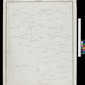
Map of the Island of Singapore and its dependencies

event1898

location_onSingapore

Map of Singapore Island, divided into Districts, including the surrounding islands and straits. The city centre, roads and forests are marked. MacRitchie Reservoir is at the centre of the island, with coconut plantations along the east coast.

A map of the Malay Peninsula

event1898

location_onMalaysia, Singapore, Thailand

Map of the Malay Peninsula showcasing the Straits Settlements in pink, the Federated Malay States in red, and Siamese states in yellow. A table of common words in English, Malay and Siamese is included. Only four of six sheets are available.

Sketch map shewing progress of railway construction in the Federated Malay States

event1898

location_onMalaysia

Various stages of railway construction are shown on this map of the west coast of the Malay Peninsula, from stretches being surveyed to completed line. Costs are given for the construction.

Karte des Mahakam-Flusses in Borneo: Nach den aufnahme der Niederländischen Expedition zur Durchquerung Borneo's, 1896-1897

event1898

location_onIndonesia, Malaysia

Map of the Mahakam River in Borneo, based on an expedition by the Dutch explorer Dr. Anton Nieuwenhuis in the late 19th century. An inset map shows the upper reaches of the river at twice the scale of the main map.

Kaart van 't noordwestelijke gedeelte der Residentie Ambon

event1898

location_onIndonesia

Map of the residency of Ambon in the Maluku Islands, divided by colour-coded administrative borders. There are inset maps the Banda Islands—including the nutmeg plantations and the town of Neira with its fort and hospital—and of Dutch New Guinea.

close

  • Filter from 1630 to 1900

Current results range from 1630 to 1900