
Search Results
1637 Results found


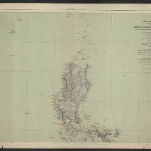
Carta general (en dos hojas) del Archipiélago Filipino
1900
Philippines
A Spanish military map of the northern Philippine island of Luzon, highlighting cable and telegraph lines, and aids to maritime navigation such as bathymetry (sea depth) and tide data. A conversion table for metres, fathoms and feet is also shown.

Commercial highways between United States and Asia and the islands of the Pacific
1900
Brunei, Cambodia, East Timor, Indonesia, Laos, Malaysia, Myanmar, Papua New Guinea, Philippines, Singapore, Southeast Asia, Thailand, Vietnam
The United States Treasury Department produced this map of trade routes crossing the Pacific Ocean between the United States and Asia. Each route is labelled with the names of its ports, and with the distance between them in miles.


Map of Asia: Printed for the New York Central's 'Four-Track Series'
1900
Malaysia, Indonesia, Thailand, Myanmar, Cambodia, Vietnam, Papua New Guinea, Philippines, Singapore, Brunei, Laos, Southeast Asia
Colonial territory is labelled and colour-coded on this map of Southeast Asia. A list on the left edge gives the colonial status, size and population of Asian countries, and ranks the main cities by population. Gold and iron mines are marked.

Map of the Spanish and American trenshes on the south of Manila
c.1900-1909
Philippines
Created by the U.S. Army during the Spanish-American War, this reconnaissance map of a small area south of Manila features Spanish (red) and American (blue) trenches, as well as roads, buildings and ground conditions (firm ground, swamps, fields).
- Filter from 1478 to 1900
- Indonesia1,345
- Malaysia802
- Thailand724
- Myanmar715
- Singapore705
- Vietnam670
- Cambodia646
- Brunei624
- Philippines617
- Laos597
- East Timor559
- Southeast Asia523
- more Simple Location »
- Java846
- Sumatra843
- Borneo693
- Malay Peninsula585
- Sulawesi553
- Celebes475
- Dutch East Indies468
- Siam389
- Maluku Islands374
- Western New Guinea360
- Sunda Islands279
- Malacca264
- more Detailed Location »
- Port211
- Pier84
- Railway Station58
- River1,179
- Road420
- Path219
- Railway/Tramway181
- Postal Route98
- Canal92
- Bridge83
- Telegraph/Telephone63
- Legend622
- Cartouche423
- Illustration357
- Inset Map330
- Elevation153
- Coat of Arms120


