Search

Search Results

Plannen van ankerplaatsen Kleine Soenda eilanden

event1893

location_onIndonesia

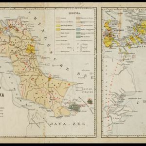
Fifty-seven separate maps of bays, roadsteads—a body of water sheltered from tides/currents—and anchor points around the Lesser Sunda Islands. Landmarks, lighthouses, bathymetry (sea depth), shoals, reefs and other obstructions are marked.

Kaart van de dichtheid van bevolking van Java en Madoera

event1892

location_onIndonesia

This map shows the population density of Java and Madura in 1892. The area is divided into regencies, which are then subdivided into districts, with the districts shaded to represent its population. Each district is also listed under its regency.

Kaart van den op Java en Madoera reeds in gebruik genomen grond

event1892

location_onIndonesia

Land usage statistics are shown on this map of Java and Madura. The amount of land used in each district is indicated by green hash marks, and by a number giving its land use percentage. District names are listed and identified by a letter.

Kaart van de Residentie Kediri

event1891

location_onIndonesia

A map of the residency of Kediri (East Java) divided into regencies, which are then subdivided into districts. Mountains, roads, railways and rivers are shown. An inset map shows distances between settlements by road, tracks and paths.

Kaart van het gebied bezet in Groot-Atjeh

event1891

location_onIndonesia

A map of Groot-Atjceh and the city of Kota Radja (modern Banda Aceh) at the northern tip of Sumatra, detailing routes (rivers, roads, railways), crops (rice, banana, sugarcane, betel, reed, alang-alang, bamboo) and land features (forests, wetlands).

Midden-Flores (Terrein van actie der Noord-Flores-expeditie)

event1890

location_onIndonesia

Map of central Flores in the Lesser Sunda Islands, with extensive written notes describing the island, e.g. where the first Christians settled; the territories of local rulers; areas where Christians were replaced by Muslims; locations of tin mines.

Kaart van den Nederlandsch-Indischen Archipel

event1890

location_onIndonesia, East Timor, Brunei, Cambodia, Malaysia, Philippines, Singapore, Southeast Asia, Thailand, Vietnam

The seas of the Dutch East Indies are the focus of this map, with maritime routes, sea temperature, sea depth, currents and monsoons shown. There are graphs of population by ethnicity, agriculture and livestock, trade and shipping, and trade exports.

Kaart van het eiland Flores

event1890

location_onIndonesia

Hand-drawn map of Flores in the Lesser Sunda Islands, with extensive written notes describing the island, e.g. the interior is unknown to Europeans; the names of the main Christian villages are underlined.

Kaart der Bataklanden en van het eiland Nijas

event1890

location_onIndonesia

A large-scale map of northern Sumatra, spread over 16 sheets, and divided into administrative regions. The island of Nijas (Nias) is marked with the locations of local tribes, and there is a list of other maps referenced in producing the map.

Kaart van Zuid Celebes met uitzondering van het rijk Gowa

event1890

location_onIndonesia

Detailed topographical map of South Celebes (Sulawesi) spread over four sheets, featuring crops (coffee, alang-alang, rice), fishing ponds, salt panning. With two additional maps of the island of Saleijer (Selayar) and Pitoempanoewae (Pitumpanua).

[Reisroute zuidelijk deel van het Toba meer]

event1889

location_onIndonesia

The red lines on this hand-drawn map of the southern part of Lake Toba, Sumatra, mark two ‘signal routes’ [‘sein route’]. Both start and return to the town of Balige on the lake’s southern shore. Dates on one of the routes cover four days.

Schets-taalkaart van de residentie Bangka / Schets-taalkaart van den Riouw- en Lingga-archipel

event1889

location_onIndonesia

Two separate maps showing the languages and dialects spoken on the islands of Bangka, and the Riouw (Riau) and Lingga archipelagos, in the late 19th century. On Bangka alone, there are 12 languages or dialects listed.

close

  • Filter from 1595 to 1899

Current results range from 1595 to 1899