Search

Search Results

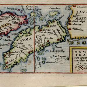
Svmatra cum circumiacentibus insulis

event1601

location_onIndonesia, Malaysia, Singapore

A colourful early 17th century map of Sumatra, Java and the Malay Peninsula, with North located to the left, and major settlements marked. Latin text on the reverse describes the peoples, religions, languages, agriculture, mining etc. of the region.

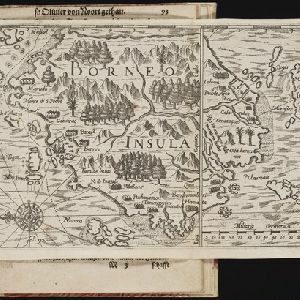
Borneo Insula

eventc.1600-1699

location_onMalaysia, Indonesia

An early map of the island of Borneo, depicting the natural landscape of mountains, forests, rivers and shoals, and also evidence of human habitation with houses representing settlements, and a port and shipping route along the northern coast.

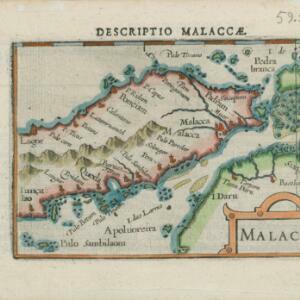
Descriptio Malaccae

eventc.1600-1699

location_onMalaysia, Singapore, Indonesia

Latin text on the reverse of this map describes Malacca, including crops and products (rice, pepper, spices, pearls), precious metals (gold, silver and tin), and animals (sheep, elephant), showing the city’s importance to European trade at the time.

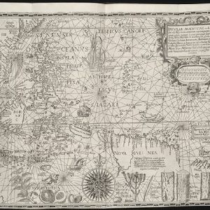
Insvlae Molvccae

event1598

location_onBrunei, Cambodia, East Timor, Indonesia, Laos, Malaysia, Papua New Guinea, Philippines, Singapore, Southeast Asia, Thailand, Vietnam

A map featuring drawings of plants used to make spices in the Moluccas or Spice Islands: Nux Myristica (nutmeg), Cariophilorum arbor (cloves), Santalum flavum (yellow sandalwood), Santalum rubrum (red sandalwood), Santalum album (Indian sandalwood).

close