Search

Search Results

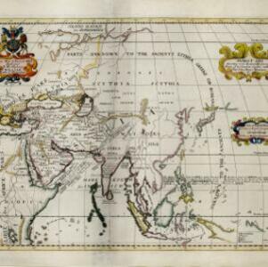
Ancient Asia according to its general divisions and names of its countries together with their chief cities, rivers, mountains &c.

event1700

location_onBrunei, Cambodia, East Timor, Indonesia, Laos, Malaysia, Myanmar, Philippines, Singapore, Southeast Asia, Thailand, Vietnam

Interestingly, this map from the year 1700 shows the world as the Greeks and Romans knew it. Therefore, Southeast Asia is labelled as 'PARTS UNKNOWN TO THE ANCIENTS' and lacks place names e.g. Sumatra is named ‘Taprobana I. according to some’.

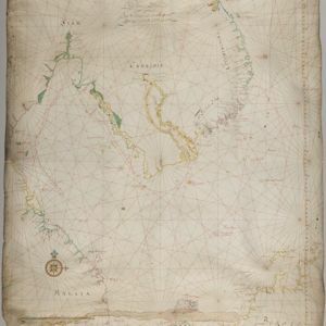
[Portolan chart of the Gulf of Siam]

event1697

location_onThailand, Vietnam, Malaysia, Cambodia

A brightly-coloured hand-drawn map of the Gulf of Siam, made for a ship’s captain. The elaborate compass roses are the centre of a rhumbline network, a web of lines to aid navigation. Bathymetry (sea depth), islands, shoals and reefs are also marked.

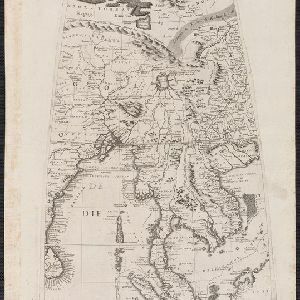
[Globe gore covering Asia]

eventc.1693-1707

location_onMalaysia, Cambodia, Indonesia, Laos, Myanmar, Singapore, Thailand, Vietnam

On this map, ‘Lago di Chiamay’, one of number of mythical lakes once thought to exist in southern China, feeds five rivers—labelled ‘Menam’, ‘Pegu’ ‘Maraban’, ‘Cosmin’ and ‘Caor’—which flow south through mainland Southeast Asia.

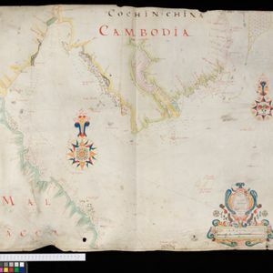
[Zuid-Chinese Zee]

event1686

location_onIndonesia, Malaysia, Thailand, Cambodia, Vietnam

Early navigation map of the South China Sea. The web of lines is a rhumbline network, while the numbers indicate sea depth (bathymetry), both used to aid navigation. A route around the Gulf of Thailand is marked with text and the dates 1643 and 1644.

Asie

event1650

location_onBrunei, Cambodia, East Timor, Indonesia, Laos, Malaysia, Myanmar, Philippines, Singapore, Southeast Asia, Thailand, Vietnam

A mid-17th century map of Asia, showing mainland Southeast Asia divided into regions such as Cochinchine, Chiampa and Tunquin (Vietnam), Sian (Thailand), Pegu, Martaban and Arracan (Myanmar), and Camboge (Cambodia).

close