Search

Search Results

Map of the Island of Singapore and its dependencies

event1898

location_onSingapore

Map of Singapore Island, divided into Districts, including the surrounding islands and straits. The city centre, roads and forests are marked. MacRitchie Reservoir is at the centre of the island, with coconut plantations along the east coast.

Handelskaart van Java en Madoera

event1898

location_onIndonesia

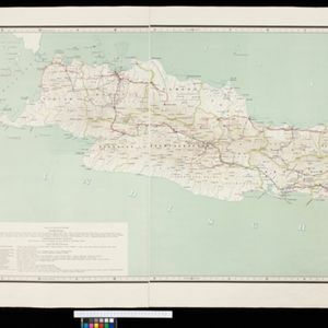
Map of Java and Madura showing routes, especially for trading purposes, including railways, tramways, roads, ports for steamship services, harbours for different types of imports and exports. A list of train and tram routes is included.

Topographische Kaart der residentie Cheribon

event1894

location_onIndonesia

Six-sheet topographic map of the residency of Cheribon (Cirebon, West Java), with an inset of a geodesic triangle grid. Administrative districts, crops—rice, alang-alang, sugarcane, sugar, coffee, tea—and indigo plant mills are shown.

New Sketch Map of the Protected Malay State of Perak

event1892

location_onMalaysia

Map of the state of Perak (Malay Peninsula) with a table of statistics: area, population, road/railway/river lengths, revenue, tin exports. Gold and tin mines are marked, and the Straits Settlements are highlighted in red.

New sketch map of the protected Malay State of Perak

event1892

location_onMalaysia

Map of state of Perak (Malay Peninsula) with a table of statistics: area, population, road/railway/river lengths, revenue, tin exports. Straits Settlements highlighted red. Someone has added handwritten travel times/distances by steamer/road/train.

Algemeene Atlas van Nederlandsche Indie

eventc.1853-1862

location_onIndonesia

Atlas featuring over 60 detailed maps of the Dutch East Indies: 24 maps cover Java; the remainder cover the rest of the Dutch East Indies. There are three index maps. (All the maps in this atlas are also presented separately on this platform.)

Algemeene Kaart van Nederlandsch Oostindie

event1842

location_onEast Timor, Indonesia, Malaysia, Singapore

This detailed map of the Dutch East Indies in the mid-19th century is spread over eight sheets, plus a cover sheet showing the whole area. There are numerous inset maps of islands, bays, cities etc.

Chart... Shewing the Connection and respective distances by Sea, between the principal harbours and Settlements in the East Indies

event1794

location_onThailand, Myanmar, Malaysia, Indonesia

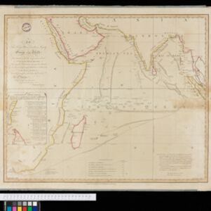
Maritime routes had to be adjusted in response to the changing monsoon seasons, as is seen on this late 18th century map of the Indian Ocean. Drawings of the heads of children blowing—called ‘wind-heads’—are used to indicate wind direction.

A new chart of the straits of Sunda: From the manuscript of the Dutch East India Company

event1794

location_onIndonesia

Navigation chart of the Sunda Strait, showing bathymetry (sea depth), shoals and reefs, landmarks, and a rhumbline network. Notes record good anchorages, sources of water and supplies etc. Inset map of the Zutphen Islands off the coast of Sumatra.

A map of the East-Indies and the adjacent countries: with the settlements, factories and territories, explaning what belongs to England, Spain, France, Holland, Denmark, Portugal &c.

event1720

location_onBrunei, Cambodia, East Timor, Indonesia, Laos, Malaysia, Myanmar, Philippines, Vietnam, Thailand, Southeast Asia, Singapore

This map showcases the colonial territories of Southeast Asia in the 18th century, with text detailing trading information and the products of each region. There are five inset maps featuring plans of specific trading ports.

close

  • Filter from 1720 to 1898

Current results range from 1720 to 1898