Search

Search Results

Atlas van Nederlandsch Oost-Indië

eventc.1897-1904

location_onIndonesia

Very detailed atlas of the entire Dutch East Indies, over 16 map sheets, with a cover and overview map. Includes topographic maps, inset maps of cities and islands, and maps featuring land and sea routes, languages, geology, colonial territory etc.

Kaart van het Westelijk gedeelte bezet in Groot-Atjèh

event1895

location_onIndonesia

This map of Groot-Atjèh (Aceh, northern Sumatra) focuses on the western part occupied during the Aceh War. It shows mountains, wetlands, forests, villages, routes and crops (rice, coconut, banana, sugar, sugarcane, bamboo, alang-alang, betel).

Kaart van het terrein des oorlogs in Groot-Atjeh

event1883

location_onIndonesia

The Aceh War (1873–1904) between the Sultanate of Aceh and Dutch colonists is highlighted on this map of Groot-Atjeh in 1876. Flag symbols mark the locations of Dutch military posts, and some villages are described as ‘verbrande [burnt]’.

Kaart van het terrein des Oorlogs in Groot-Atjeh in 1876

event1883

location_onIndonesia

The Aceh War (1873–1904) between the Sultanate of Aceh and Dutch colonists is highlighted on this map of Groot-Atjeh in 1876. Flag symbols mark the locations of Dutch troops, while a red line records the route marched by ‘agitating troops’ in 1875-6.

Kaart van Groot-Atjeh

event1878

location_onIndonesia

This map of Groot-Atjeh (Aceh, northern Sumatra) focuses on the area in and around the city of Kota Radja (Banda Aceh) during the Aceh War. It shows current and former Dutch military fortifications, inhabited and abandoned villages, and rice paddies.

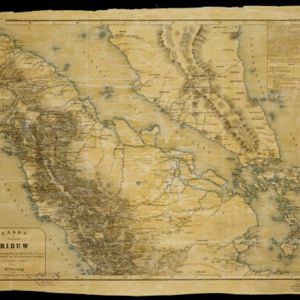
Kaart der residentie Riouw met onderhoorigheden, aangrenzend deel van Sumatra's Westkust en schiereiland Malakka

event1871

location_onIndonesia, Malaysia, Singapore

Map of the Riouw (Riau) Residency, Sumatra. The border between Riau and the island’s west coast is marked in red ‘as far as it is known [voor zoo verre die... bekend is]’, ending abruptly in the unexplored mountains near Lake Toba, northern Sumatra.

Nederlandsch Oost-Indie

event1867

location_onBrunei, East Timor, Indonesia, Malaysia, Philippines, Singapore, Thailand

Map of the Dutch East Indies, divided into administrative regions with coloured borders. There is an inset map of the important port city of Batavia (Jakarta) and its surroundings.

Oost-Indie

eventc.1867

location_onBrunei, Cambodia, East Timor, Indonesia, Laos, Malaysia, Myanmar, Philippines, Singapore, Southeast Asia, Thailand, Vietnam

Map of the East Indies in the mid-19th century, with Dutch colonial territory (Dutch East Indies) coloured in brown. Dutch administrative regions—such as residencies (‘residentie’) and governorates (‘gouvernement’)—are labelled.

Algemeene Atlas van Nederlandsche Indie

eventc.1853-1862

location_onIndonesia

Atlas featuring over 60 detailed maps of the Dutch East Indies: 24 maps cover Java; the remainder cover the rest of the Dutch East Indies. There are three index maps. (All the maps in this atlas are also presented separately on this platform.)

Nederlandsch Oost-Indië / Java

eventc.1850

location_onBrunei, East Timor, Indonesia, Malaysia, Philippines, Singapore, Thailand

Two maps of the Dutch East Indies: one of the whole region, and one of Java alone. Both are divided into administrative regions—e.g. Java is divided into regencies—with coloured borders.

close

  • Filter from 1770 to 1897

Current results range from 1770 to 1897