
Search Results
10 Results found


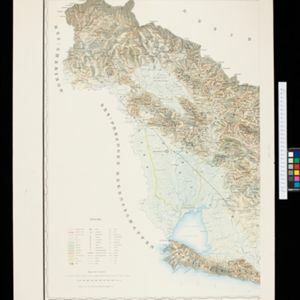
Topographische kaart van de residentie Preanger regentschappen
1894
Indonesia
The residency of Preanger (Parahyangan), West Java, with plantations (coconut, coffee, tea, cinchona (‘kina’), betel, teakwood, bamboo) and crops (rice, sugarcane, alang-alang). Two inset maps: a triangulation map, and a map of land route distances.

Topographische Kaart der residentie Pekalongan
1892
Indonesia
Topographic map of the residency of Pekalongan (Central Java), divided into regencies (pink borders) and districts (yellow borders). Mountains, forests, settlements, routes, crops—alang-alang, coffee, sugar, rice—factories and warehouses are shown.


Topographische kaart der residentie Besoeki
1888
Indonesia
The residency of Besoeki (Besuki), East Java, featuring crops (rice, alang-alang, bamboo, coconut); fishing ponds; factories, warehouses, businesses; routes, administrative borders; churches, cemeteries, forts, lighthouses; mountains, rivers, lakes.


Topographische kaart der residentie Semarang
c.1869-1871
Indonesia
The residency of Semarang, Central Java, featuring crops (coffee, rice, bamboo, nipa palm); warehouses, cemeteries, post offices; routes, administrative borders; mountains, rivers, forests. An inset map shows updated details of the Kendal district.

Topographische kaart der residentie Pekalongan
1870
Indonesia
Topographic map of the residency of Pekalongan (Central Java), divided into regencies (pink borders) and districts (yellow borders). Mountains, forests, settlements, routes, crops—alang-alang, coffee, sugar, rice—factories and warehouses are shown.

- Filter from 1861 to 1898
- Dutch10
- [remove]Cemetery/Columbarium10
- Kampong/Village10
- [remove]Post Office10
- Residential Area7
- Mosque5
- Well5
- Military Fort4
- Church2
- Hospital2
- Military Barracks2
- Temple2
- Court of Law1
- Jail/Prison1
- Police Station1
- more Settlement Features »
- Crops10
- [remove]Plantation/Forestry Area10
- Agricultural Pond1
- Fishing1
- [remove]Path10
- [remove]Postal Route10
- Road10
- River7
- Railway/Tramway6
- Telegraph/Telephone3
- Canal2
- Bridge1
- [remove]Jungle/Wooded Area10
- Mountain/Volcano10
- [remove]Wetlands10


