
Search Results


Kaart van Padang Si Dimpoewan en omstreken
1895
Indonesia
Map of Padang Si Dimpoewan (modern city of Padangsidempuan, northern Sumatra) including a military camp and accommodation, schools, a market, jail and graveyard. Crops are grown in the surrounding area: rice, coconut, coffee, alang-alang, bamboo.


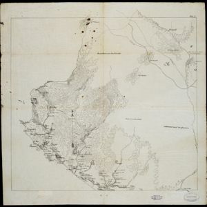
Kaart van het Westelijk gedeelte bezet in Groot-Atjèh
1895
Indonesia
This map of Groot-Atjèh (Aceh, northern Sumatra) focuses on the western part occupied during the Aceh War. It shows mountains, wetlands, forests, villages, routes and crops (rice, coconut, banana, sugar, sugarcane, bamboo, alang-alang, betel).

Schetskaart der voormalige Ooster-buitenlinie
1895
Indonesia
Produced during the Aceh War, the ‘Ooster-buitenlinie [Eastern outer line]’ of this map’s title probably refers to Dutch troop positions—marked with flag symbols—along the red road on the left. The road is east of the city of Kota Radja (Banda Aceh).


Topographische kaart der residentie Soerabaja
1895
Indonesia
The residency of Soerabaja, East Java, featuring crops (coffee, coconut, sugarcane, rice, alang-alang, bamboo) and fishing ponds. Three inset maps: a triangulation map; a map of distances between settlements by types of transport; Bawean Island.


- Filter from 1540 to 1900
- [remove]Mountain/Volcano219
- Jungle/Wooded Area137
- Wetlands111
- Wild Animals34
- Mangrove6


