
Search Results


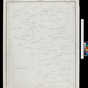
Overzichtskaart van de Residentie Besoeki
1899
Indonesia
This map of the residency of Besoeki (Banyuwangi Regency, East Java) is divided into regencies and districts. Heights of mountains and settlements are given in metres, and distances are shown along roads. Sugar factories and fishing ponds are marked.


Kaart der residentie Zuider- en Ooster-afdeeling van Borneo
1899
Indonesia
On this map, the residency of South and East Borneo is divided into departments (green borders) and provinces (yellow borders). There is an inset plan of the city of Banjarmasin, with rivers, buildings, residential areas, roads and crops marked.

Kaart van de Vallei van Pidië, de Moekim VII en de Vallei van Tangsé
1899
Indonesia
Large-scale topographic map of the northeast coast of Sumatra around the city of Sigli, Aceh, spread over 16 sheets plus a cover sheet of the whole area. The map focuses on two river valleys, mountains, marshland, villages and rice paddies.

Map of Singapore and surrounding country
1899
Malaysia, Singapore, Indonesia
Map of Singapore Island, including the surrounding islands and straits, and southern Johor. Lighthouses are marked in red and yellow, including Horsburgh Lighthouse on Pedra Branca, Raffles Lighthouse and Fort Canning Lighthouse.


A map of British North Borneo
1899
Malaysia, Brunei, Indonesia
The colonial territories of British North Borneo are shown in pink on this late 19th century map, with Brunei and Sarawak in green, and Dutch colonial territory in yellow. Sea routes around the British Empire are depicted on an inset map.


- Filter from 1478 to 1900
- Indonesia934
- Malaysia563
- Thailand524
- Myanmar523
- Singapore489
- Vietnam479
- Cambodia454
- Laos433
- Brunei427
- Philippines416
- East Timor362
- Southeast Asia355
- more Simple Location »
- Java582
- Sumatra576
- Borneo480
- Malay Peninsula425
- Dutch East Indies379
- Sulawesi370
- Celebes302
- Siam285
- Western New Guinea247
- Maluku Islands239
- Sunda Islands194
- Malacca189
- more Detailed Location »
- Port140
- Pier62
- Railway Station49
- [remove]River1,179
- Road391
- Path205
- Railway/Tramway158
- Canal92
- Postal Route87
- Bridge79
- Telegraph/Telephone50


