Search Results
10 Results found
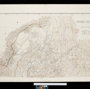

Stanford's Map of the Empires of China & Japan with the adjacent parts of the Russian Empire, India, Burma &c.
1896
Myanmar, Vietnam
The most northern part of Southeast Asia is shown on this map of China and Japan, with Burma (Myanmar) and Tong-King (Vietnam) appearing at the bottom of the map. Mountains, rivers and settlements are marked, as well as a railway line in Burma.

Route chart to India and the East
1895
Brunei, Cambodia, East Timor, Indonesia, Laos, Malaysia, Myanmar, Philippines, Singapore, Southeast Asia, Thailand, Vietnam
Map of Asia featuring steamship routes—including around Southeast Asia—connecting ports such as Penang, Singapore, Batavia (Jakarta), Saigon, Bangkok, Rangun (Yangon), Manila, Macassar (Makassar) etc. There is also an inset map of Singapore.


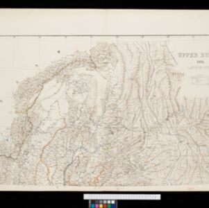
Stanford's Map of the Empires of China & Japan with the adjacent parts of the Russian Empire, India, Burma &c.
1895
Myanmar, Vietnam
The most northern part of Southeast Asia is shown on this map of China and Japan, with Burma (Myanmar) and Tong King (Vietnam) appearing at the bottom of the map. Mountains, rivers and settlements are marked, as well as a railway line in Burma.