Search

Search Results

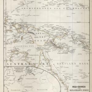
Neu-Guinea und benachbarte Inseln

event1869

location_onPapua New Guinea, Indonesia

From August Petermann's ‘Geographische Mittheilungen’, this map of New Guinea and neighbouring islands is marked with a maritime route from the western tip of New Guinea that is labelled ‘from Batavia to Hong Kong in 35 days’ and dated 1846.

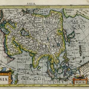
Asia

eventc.1609-1621

location_onBrunei, Cambodia, East Timor, Indonesia, Laos, Malaysia, Myanmar, Philippines, Singapore, Southeast Asia, Thailand, Vietnam

This early 17th century map of Asia by Jodocus Hondius was based on the earlier work of the Gerard Mercator. Hondius republished Mercator’s ‘Atlas’, with additional maps, which was instrumental in re-establishing Mercator’s reputation.

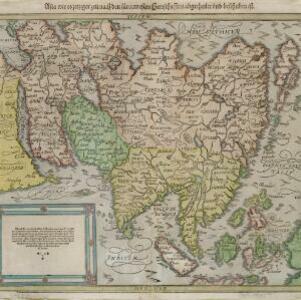
Asia wie es jetziger zeit nach den fuernemesten Herrschafften abgetheilet und beschriben ist

eventc.1588-1628

location_onBrunei, Cambodia, East Timor, Indonesia, Laos, Malaysia, Myanmar, Philippines, Singapore, Southeast Asia, Thailand, Vietnam

This early German map of Asia is colour-coded by region, and features a brief description of Asia in blackletter German text. Interestingly, the Southeast Asian island of Sumatra is labelled 'Taprobana' which is the name the Greeks called Sri Lanka.

close

  • Filter from 1588 to 1869

Current results range from 1588 to 1869