
Search Results
8 Results found


Algemeene kaart van Nederlandsch Oostindie
c.1839-1855
East Timor, Indonesia, Malaysia, Singapore
This map of the Dutch East Indies is spread over eight sheets, with a hand-drawn cover sheet showing the whole area. There are numerous inset maps of islands, bays, cities etc. Two of the inset maps have a replacement map pasted over them.

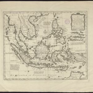
Nieuwe en Naukeurige Kaart der Oost-Indische Eilanden
1774
Brunei, Cambodia, East Timor, Indonesia, Laos, Malaysia, Myanmar, Philippines, Singapore, Southeast Asia, Thailand, Vietnam
Some regions on this map of Southeast have a descriptive label: New Guinea is described as unknown to Europeans; Borneo was abandoned by Europeans due to the ‘unmanageability’ of the inhabitants; the Philippines were discovered by Spain in 1565.
Nieuwe en naukeurige kaart der Oost-Indische Eilanden
c.1770
Brunei, Cambodia, East Timor, Indonesia, Laos, Malaysia, Myanmar, Philippines, Singapore, Southeast Asia, Thailand, Vietnam
Some regions on this map of Southeast have a descriptive label: Sumatra is described as having mines of gold, silver, iron, and sulphur; and elephants, tigers, rhinoceroses, dragons and crocodiles. Gilolo has rice, sago and turtles. Ambon has nutmeg.

Asiae recentissima delineatio, qua Status et Imperia totius Orientis unacum Orientalibus Indiis exhibentur
1716
Vietnam, Myanmar, Papua New Guinea, Philippines, Singapore, Southeast Asia, Thailand, Malaysia, Laos, Indonesia, East Timor, Cambodia, Brunei
This map's cartouche features an illustration of three men bowing before an enthroned ruler. A second image is of a procession where a horned four-armed humanoid creature is being carried on poles by two bearers, while musicians follow behind.

India quae Orientalis dicitur, et insvlae adiacentes
c.1645-1658
Brunei, Cambodia, East Timor, Indonesia, Laos, Malaysia, Myanmar, Philippines, Singapore, Southeast Asia, Thailand, Vietnam
German text on the reverse of this map describes the populations, crops, trade etc. of Sumatra, Borneo, Philippines, and Banda Islands. There are drawings of sailing ships, and the map is dedicated to the Dutch merchant Christophoro Thisio.
- Filter from 1645 to 1842
- [remove]Jungle/Wooded Area8
- Mountain/Volcano8
- Wild Animals5
- Wetlands2
- [remove]Compass Rose8
- [remove]Longitude and Latitude8
- [remove]Written Note/Details8
- Scale7
- Contour Lines/Elevation2
- Rhumbline Network1


