
Search Results
Filter
Map Maker
Versteeg, W.F.
Remove constraint Map Maker: Versteeg, W.F.
Land Routes
River
Remove constraint Land Routes: River
Settlement Features
Kampong/Village
Remove constraint Settlement Features: Kampong/Village
Settlement Features
Residential Area
Remove constraint Settlement Features: Residential Area
4 Results found

Kaart van de Oosterhelft der Residentie Timor
1860
Indonesia
Map of the eastern half of the Dutch colonial administrative region (residency) of Timor, with an inset map of its capital city and port Timorkoepang (Kupang). (From ‘Algemeene Atlas van Nederlandsche Indie [General Atlas of the Dutch East Indies]’.)


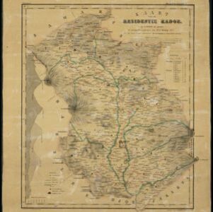
Kaart van de westerhelft der residentie Rembang
1858
Indonesia
Topographic map of the residency of Rembang, Central Java, divided into regencies and districts. Roads and villages are marked, with shoals, reefs and water depth at sea. An inset map of the city of Rembang features markets, warehouses, churches.
- Filter from 1858 to 1867
- [remove]Kampong/Village4
- [remove]Residential Area4
- Church3
- Temple3
- Cemetery/Columbarium2
- Jail/Prison2
- Military Fort2
- Mosque2
- Post Office2
- Palace1


