Search

Search Results

A map of Java: chiefly from surveys made during the British administration

event1817

location_onIndonesia

Made for ‘A History of Java’ by Sir Stamford Raffles, this map includes a list of administrative districts with their populations, and four inset maps of harbours. Another inset map shows rocks and minerals, mountains and volcanoes, and teak forests.
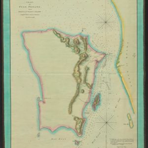
Chart of Pulo Penang: now Prince of Wales's Island

event1805

location_onMalaysia

Map focusing on the passage between Penang Island and the mainland, with shoals and reefs marked and described, and bathymetry (sea depth) shown. There are anchor points at George Town harbour, and landmarks—hills, trees, a fort—to aid navigation.

close

  • Filter from 1805 to 1817

Current results range from 1805 to 1817