Search

Search Results

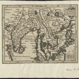
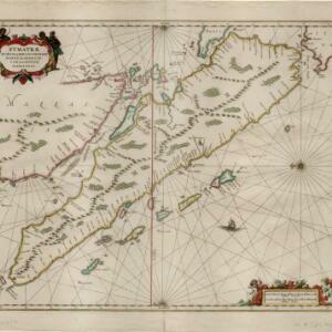
Svmatrae et insularum locorumque nonnullorum circumiacentium tabula noua

eventc.1657-1680

location_on
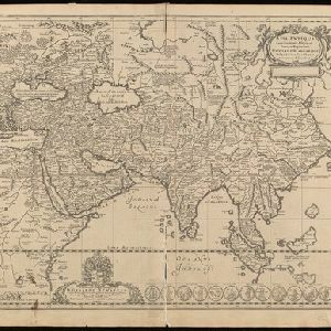
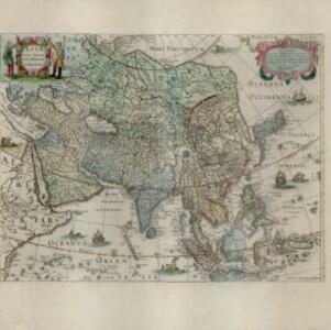
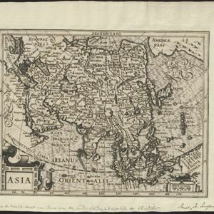
Indonesia, Malaysia, Singapore

Mountains and jungles are shown pictorially on this map of Sumatra and surrounding islands. The cartouche is decorated with Asian warriors; the scale with cherubs playing with cartography tools. From Jan Jansson’s Latin edition of ‘Atlas Maritimus’.

Asiæ nova delineatio

eventc.1656-1677

location_onBrunei, Cambodia, East Timor, Indonesia, Laos, Malaysia, Myanmar, Philippines, Singapore, Southeast Asia, Thailand, Vietnam

This colourful mid-17th century map was originally published in the Dutch cartographer Nicolaes Visscher's ‘Atlas contractus’. The map is dedicated to D. Henry Spiegel, consul and senator of the city of Amsterdam, and features his coat of arms.

Asiae nova descriptio

event1653

location_onBrunei, Cambodia, East Timor, Indonesia, Laos, Malaysia, Myanmar, Philippines, Southeast Asia, Singapore, Thailand, Vietnam

A mid-17th century map of Asia decorated with a border of drawings of Asian cities and Asian rulers, including the port of Bantam (Banten) at the western end of Java, and a portrait of ‘Rex Moluccae’ the ‘king’ of the Moluccas (Maluku Islands).

Asia antiqua cum finitimis Africae et Europae regionibus

event1652

location_onIndonesia, Malaysia, Brunei, Philippines, Cambodia, Vietnam, Thailand, Laos, Myanmar, Southeast Asia, Singapore

This mid-17th century map of Asia is missing most of the southern and eastern parts of Southeast Asia, such as the Philippines and most of modern Indonesia. Instead, there is a note stating that there are reported to be numerous islands in the area.

Asia recens summa cura delineata

eventc.1646-1657

location_onBrunei, Cambodia, East Timor, Indonesia, Laos, Malaysia, Myanmar, Philippines, Singapore, Southeast Asia, Thailand, Vietnam

A map of Asia decorated with illustrations of sea monsters, strange creatures and ships. There is Latin text on the back of the map describing Asia.

India quae Orientalis dicitur, et insvlae adiacentes

eventc.1645-1658

location_onBrunei, Cambodia, East Timor, Indonesia, Laos, Malaysia, Myanmar, Philippines, Singapore, Southeast Asia, Thailand, Vietnam

German text on the reverse of this map describes the populations, crops, trade etc. of Sumatra, Borneo, Philippines, and Banda Islands. There are drawings of sailing ships, and the map is dedicated to the Dutch merchant Christophoro Thisio.

Asia noviter delineata

event1640

location_onBrunei, Cambodia, East Timor, Indonesia, Laos, Malaysia, Myanmar, Philippines, Singapore, Southeast Asia, Thailand, Vietnam

This map is illustrated with drawings of Asian people wearing traditional clothing, including representatives of Sumatra, Java and the Maluku Islands. There are also drawings of important ports such as Bantam (Banten) at the western end of Java.

India orientalis et insulæ adiecentes

event1638

location_onBrunei, Cambodia, East Timor, Indonesia, Laos, Malaysia, Myanmar, Philippines, Singapore, Southeast Asia, Thailand, Vietnam

First published in Johann Ludwig Gottfried's ‘Newe Archontologia Cosmica’ in 1638, this map was based on a 1634 map by Willem Janszoon Blaeu. The cartouche features drawings of two men in ‘eastern’ clothing, holding septres, a sword and a shield.

India orientalis

event1636

location_onBrunei, Cambodia, Indonesia, Laos, Malaysia, Myanmar, Philippines, Singapore, Thailand, Vietnam

As was common in this era, this map mistakenly shows the bottom of Peninsula Malaya as a separate island. The map also features illustrations of ships and a sea monster. Text on the reverse describes the people, crops, geography of the region.

Asia noviter delineata

eventc.1635-1638

location_onBrunei, Cambodia, East Timor, Indonesia, Laos, Malaysia, Myanmar, Philippines, Singapore, Southeast Asia, Thailand, Vietnam

This map is illustrated with drawings of Asian people wearing traditional clothing, including representatives of Sumatra, Java and the Maluku Islands. There are also drawings of important ports such as Bantam (Banten) at the western end of Java.

Asia

event1634

location_onBrunei, Cambodia, East Timor, Indonesia, Laos, Malaysia, Myanmar, Philippines, Singapore, Southeast Asia, Thailand, Vietnam

Early Latin map of Asia, with some inaccuracies: only a small part of Java (labelled ‘Iava Major’) is shown, the shape of Celebes (Sulawesi) is much simplified, and New Guinea is enlarged and distorted.

India Orientalis

event1634

location_onBrunei, Cambodia, Indonesia, Laos, Malaysia, Myanmar, Philippines, Thailand, Vietnam, Singapore, Southeast Asia

This 17th century map features a number of mythical lakes once thought to exist in southern China. One of these lakes (‘Chiamai Lac’) feeds three rivers—labelled ‘Menan’, ‘Manthabam’ and ‘Cosmin’—which flow south through mainland Southeast Asia.

close