
Search Results
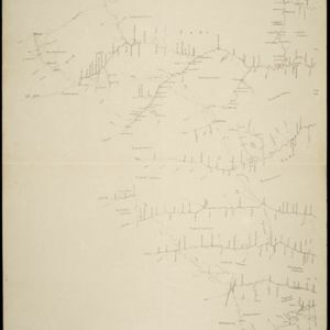

Kaart van het gebied bezet in Groot-Atjeh, met de nederzettingen Lepoeng en Lehoeng
1897
Indonesia
A map of Groot-Atjeh, Lepoeng and Lehoeng, at the northern tip of Sumatra, detailing routes (rivers, roads, railways), crops (rice, banana, sugarcane, betel, pepper, alang-alang, bamboo) and land features (forests, mountains, wetlands).

Atlas van Nederlandsch Oost-Indië
c.1897-1904
Indonesia
Very detailed atlas of the entire Dutch East Indies, over 16 map sheets, with a cover and overview map. Includes topographic maps, inset maps of cities and islands, and maps featuring land and sea routes, languages, geology, colonial territory etc.

Kaart van het gebied bezet in Groot-Atjeh, met de nederzettingen Lepoeng en Lehoeng
1897
Indonesia
A map of Groot-Atjeh, Lepoeng and Lehoeng, at the northern tip of Sumatra, detailing routes (rivers, roads, railways), crops (rice, banana, sugarcane, betel, pepper, alang-alang, bamboo) and land features (forests, mountains, wetlands).

Kaart van de residentie Oostkust van Sumatra
1896
Indonesia
Detailed topographical map of the east coast of Sumatra, spread over 36 sheets. The area’s farms are listed and shown on the map within yellow borders, with types of crop grown. There is a detailed plan of Medan, and five inset maps of other towns.

Sumatra: Residentie Benkoelen (Bengkoelen)
c.1894-1895
Indonesia
Map of the residency of Benkoelen (Bengkulu, southwest coast of Sumatra), over 10 sheets, with an inset map of the city of Bengkoelen (Bengkulu). Types of crops—coconut, rice, alang-alang, nipah palm, coffee—are marked. Sheet number 8 is missing.

Kaart van het Westelijk gedeelte bezet in Groot-Atjèh
1895
Indonesia
This map of Groot-Atjèh (Aceh, northern Sumatra) focuses on the western part occupied during the Aceh War. It shows mountains, wetlands, forests, villages, routes and crops (rice, coconut, banana, sugar, sugarcane, bamboo, alang-alang, betel).

Schetskaart der voormalige Ooster-buitenlinie
1895
Indonesia
Produced during the Aceh War, the ‘Ooster-buitenlinie [Eastern outer line]’ of this map’s title probably refers to Dutch troop positions—marked with flag symbols—along the red road on the left. The road is east of the city of Kota Radja (Banda Aceh).

Oostkust Sumatra. Schetskaart der Siak Rivier van het Eiland Tengah tot Siak
1894
Indonesia
This late 19th century large-scale (1:30,000) map show just a section of the Siak River, in the Riau province of Sumatra. Bathymetry (water depth) is shown in figures to aid navigation, with various landmarks noted along the river’s banks.

Sumatra Oostkust: Monden der Koealoe en Panei rivieren
1892
Indonesia
Navigation map of the mouths of the Koealoe (Kualu) and Panei (Barumun and Bila) rivers on the east coast of Sumatra. Large sand and mud banks, bathymetry (sea depth), bouys and currents are marked. On land, tall trees are shown to use as landmarks.

Schetskaart van het terrein doorloopen bij de excursie in 1890 tegen de Battaksche landschappen Loemban-Pinasa en Djandji
1891
Indonesia
Map of an expedition route—in red—through the country of the Batak people of northern Sumatra, from Lake Toba to Loemban-Pinasa (Lumban Pinasa) and Djandji. Mountains and forests are shown, along with two drawings of views of hills.

Kaart van de residentie Oostkust van Sumatra
1889
Indonesia
Detailed topographical map of the east coast of Sumatra, spread over 34 sheets. The area’s farms are listed and shown on the map, with types of crop grown. With five inset maps of individual towns. Two sheets and the cover sheet are missing.
- Filter from 1547 to 1898
- [remove]Jungle/Wooded Area28
- Mountain/Volcano23
- Wetlands23
- Wild Animals2
- Mangrove1


