Search

Search Results

Plan of the road and city of Batavia on the north coast of Java Island

event1790

location_onIndonesia

Map of the Batavia (Jakarta) Bay roadstead, a body of water sheltered from tides/currents, for ships to anchor. The web of lines is a rhumbline network, the numbers indicate sea depth (bathymetry), and there are written notes, all to aid navigation.
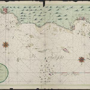
Nieuwe afteekeningh van de Noord Küst van Java vertoonende de reede van Batavia en Bantem

event1740

location_onIndonesia

A map of the northern coast of Java and the important port cities of Batavia (Jakarta) and Bantem (Banten). The web of lines is a rhumbline network, and shoals, reefs and bathymetry (sea depth) are marked, all to aid navigation.

close

  • Filter from 1740 to 1790

Current results range from 1740 to 1790