Search

Search Results

Plan of the town and suburbs of Rangoon

eventc.1895-1897

location_onMyanmar

Detailed plan of the city of Rangoon (Yangon, Myanmar) with commercial, religious, government and military buildings, surrounded by lakes, fields of crops and villages. Someone has drawn details on the map of areas that have undergone ‘levelling’.

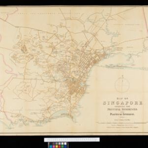
Map of Singapore showing the principal residences and places of interest

event1892

location_onSingapore

Map of the city of Singapore, including the central civic/business area around the Singapore River, Fort Canning, Tanjong Pagar dock, and residential areas. The city is surrounded by villages and plantations (pineapple, fruit and vegetable, coconut).

Map of the Malay Peninsula 1879

event1879

location_onMalaysia, Singapore, Thailand

Six-sheet map of the Malay Peninsula, featuring settlements, mountains and rivers. Labels note names of indigenous peoples, or describe terrain/resources. There is an inset map of Singapore town, and the Straits Settlements are highlighted in red.

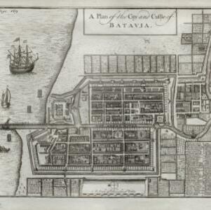
A plan of the city and castle of Batavia

event1746

location_onIndonesia

A mid-18th century plan of Batavia (Jakarta), the main port of the Dutch East India Company's trading network in Southeast Asia. Ships can be seen transporting goods along ‘The Great River’ to the sea, overseen by Batavia Castle at the river’s mouth.

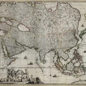
A new mapp of Asia: divided into kingdoms & provinces

event1690

location_onBrunei, Cambodia, East Timor, Indonesia, Laos, Malaysia, Myanmar, Philippines, Singapore, Southeast Asia, Thailand, Vietnam

A detailed late 17th century map of Asia, showing ancient kingdoms and the place names of important settlements. The cartouche features a drawing of Asian traders selling their goods, while a camel, monkey and two birds look on.

close

  • Filter from 1690 to 1895

Current results range from 1690 to 1895