
Search Results
Filter
Map Attributes
Compass Rose
Remove constraint Map Attributes: Compass Rose
Insets
Illustration
Remove constraint Insets: Illustration
Land Routes
River
Remove constraint Land Routes: River
Political Regions
Regional Border
Remove constraint Political Regions: Regional Border
48 Results found


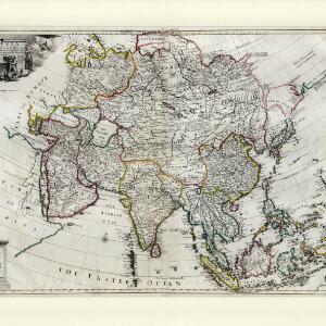
A map of the East-Indies and the adjacent countries: with the settlements, factories and territories, explaning what belongs to England, Spain, France, Holland, Denmark, Portugal &c.
1720
Brunei, Cambodia, East Timor, Indonesia, Laos, Malaysia, Myanmar, Philippines, Vietnam, Thailand, Southeast Asia, Singapore


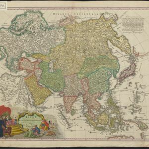
L'Asie divisée en ses principales regions, et ou se peuvent voir l'estendue des Empires, Monarchies, Royaumes, et Estats qui partagent présentement l'Asie
c.1700
Brunei, Cambodia, East Timor, Indonesia, Laos, Malaysia, Myanmar, Papua New Guinea, Philippines, Singapore, Southeast Asia, Thailand, Vietnam
- [remove]Regional Border48
- Civic/Metropolitan Border2
- Colonial Possessions1
- Cartouche48
- [remove]Illustration48
- Coat of Arms14
- Inset Map5
- [remove]Compass Rose48
- Longitude and Latitude47
- Scale31
- Written Note/Details13
- Rhumbline Network8


