Search Results
4 Results found
![](https://historicalmaps.yale-nus.edu.sg/rails/active_storage/representations/eyJfcmFpbHMiOnsibWVzc2FnZSI6IkJBaHBNUT09IiwiZXhwIjpudWxsLCJwdXIiOiJibG9iX2lkIn19--7012713d18ec23d7e78b6e9d7d5c70f3a33edcc1/eyJfcmFpbHMiOnsibWVzc2FnZSI6IkJBaDdCam9MY21WemFYcGxTU0lNTkRBd2VETXdNQVk2QmtWVSIsImV4cCI6bnVsbCwicHVyIjoidmFyaWF0aW9uIn19--bc467f5637e8b6d3bfb826116f92b6bfedfbf03a/bodleian-0250.jpeg)
A new and accurate map of the East India Islands: laid down according to the latest discoveries, and agreeable to the most approved maps & charts
1750
Brunei, Cambodia, East Timor, Indonesia, Laos, Malaysia, Myanmar, Vietnam, Thailand, Southeast Asia, Singapore, Philippines
This mid-18th century map of Southeast Asia includes written notes on goods produced and traded, geographical features, and wild animals found in each part of the region. The cartouche features a drawing of Asia with people, fields and palm trees.
![](https://historicalmaps.yale-nus.edu.sg/rails/active_storage/representations/eyJfcmFpbHMiOnsibWVzc2FnZSI6IkJBaHBBaVVCIiwiZXhwIjpudWxsLCJwdXIiOiJibG9iX2lkIn19--006eb0c44b9b4496f436516abb732a74e13de00a/eyJfcmFpbHMiOnsibWVzc2FnZSI6IkJBaDdCam9MY21WemFYcGxTU0lNTkRBd2VETXdNQVk2QmtWVSIsImV4cCI6bnVsbCwicHVyIjoidmFyaWF0aW9uIn19--bc467f5637e8b6d3bfb826116f92b6bfedfbf03a/bodleian-0222.jpeg)
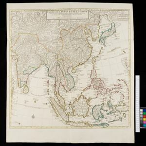
Carte des Indes et de la Chine
c.1722-1774
Brunei, Cambodia, East Timor, Indonesia, Laos, Malaysia, Myanmar, Philippines, Singapore, Southeast Asia, Thailand, Vietnam
This map uses coloured borders to show the ancient kingdoms of Southeast Asia. A label on the island of Borneo states ‘Beajous Idolatres habitans le milieu de l'Isle [Beajous idolaters inhabit the middle of the Island]’.
![](https://historicalmaps.yale-nus.edu.sg/rails/active_storage/representations/eyJfcmFpbHMiOnsibWVzc2FnZSI6IkJBaHBBcHNEIiwiZXhwIjpudWxsLCJwdXIiOiJibG9iX2lkIn19--131dbdb4c7753772513c83dab6d3bad623897b4e/eyJfcmFpbHMiOnsibWVzc2FnZSI6IkJBaDdCam9MY21WemFYcGxTU0lNTkRBd2VETXdNQVk2QmtWVSIsImV4cCI6bnVsbCwicHVyIjoidmFyaWF0aW9uIn19--bc467f5637e8b6d3bfb826116f92b6bfedfbf03a/bodleian-0441.jpeg)
To the Right Honourable William, Lord Cowper, Lord High Chancellor of Great Britain, this map of Asia
1720
Brunei, Cambodia, East Timor, Indonesia, Laos, Malaysia, Myanmar, Papua New Guinea, Philippines, Singapore, Southeast Asia, Thailand, Vietnam
Map dedicated to William Cowper, whose coat of arms sits atop the cartouche. It features two horses holding a crest with three martlets (mythical birds used in heraldry). The cartouche also features Asian traders. Monsoons are marked on the map.
- Indonesia4
- Brunei3
- Cambodia3
- East Timor3
- Laos3
- Malaysia3
- Myanmar3
- Philippines3
- Singapore3
- Southeast Asia3
- Thailand3
- Vietnam3
- more Simple Location »
- [remove]Borneo4
- Java4
- Sulawesi4
- [remove]Sunda Islands4
- Celebes3
- Malay Peninsula3
- Maluku Islands3
- Sumatra3
- Cochinchina2
- Malacca2
- New Guinea2
- Siam2
- more Detailed Location »
- [remove]Compass Rose4
- Longitude and Latitude4
- Scale3
- Written Note/Details2
- Contour Lines/Elevation1