Search

Search Results

Stanford's portable map of India shewing its present divisions and the adjacent parts of Beluchistan, Afghanistan, Turkestan, the Chinese Empire, Burmah and Siam

event1869

location_onMyanmar, Indonesia, Thailand

This two-sheet map of India includes Burma (Myanmar) and Siam. British Burma—which came under British colonial rule after the first (1824–1826) and second (1852–1853) Anglo-Burmese wars—is highlighted in red.

Übersichtskarte der Französischen Expedition in Hinterindien vom Me-khong bis zum Jang-tse-kiang

event1869

location_onMyanmar, Thailand, Vietnam, Laos

This map of the border region between China, Birma (Myanmar), Siam (Thailand and Laos) and Anam (Vietnam) is marked with the routes of five expeditions of the region from 1837 to 1868. Locations of Roman Catholic missionaries are also shown.

Nederlandsch Oost-Indie

event1867

location_onBrunei, East Timor, Indonesia, Malaysia, Philippines, Singapore, Thailand

Map of the Dutch East Indies, divided into administrative regions with coloured borders. There is an inset map of the important port city of Batavia (Jakarta) and its surroundings.

Der Indochinesischen Reiche: Birma, Siam, Kambodja und Annam

event1867

location_onCambodia, Laos, Malaysia, Myanmar, Thailand, Vietnam

The route between Saigon and Rangoon taken by the German ethnologist Adolf Bastian is marked on this map of mainland Southeast Asia. There are two inset maps of cites: Mandalay, Amarapura and Ava in Burma; and Bangkok in Siam (including 14 temples).

Nederlandsch Oost-Indie

event1867

location_onBrunei, East Timor, Indonesia, Malaysia, Philippines, Singapore, Thailand

Map of the Dutch East Indies, divided into administrative regions with coloured borders. There is an inset map of the important port city of Batavia (Jakarta) and its surroundings.

Stanford's library map of Asia

event1862

location_onBrunei, Cambodia, East Timor, Indonesia, Laos, Myanmar, Malaysia, Philippines, Singapore, Southeast Asia, Thailand, Vietnam

Map of Asia on four sheets, with Southeast Asia on sheet four. British colonial territory—British Burma, the Straits Settlements, Sarawak—is highlighted in red, with the Dutch East Indies, Spanish Philippines and Portuguese East Timor also shown.

Azië : 1861

event1861

location_onBrunei, Cambodia, East Timor, Indonesia, Laos, Malaysia, Myanmar, Papua New Guinea, Philippines, Singapore, Southeast Asia, Thailand, Vietnam

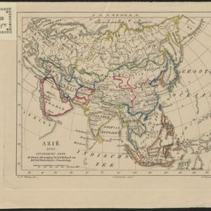
Map of Asia published by the North Holland Regional Association of the Dutch Teachers' Association. Mainland Southeast Asia is labelled ‘Achter Indie [Beyond India]’; the Indonesian Archipelago is labelled ‘Indische Archipel [Indian Archipelago]’.

Asiatic archipelago

event1858

location_onVietnam, Myanmar, Papua New Guinea, Philippines, Singapore, Southeast Asia, Thailand, Malaysia, Laos, Indonesia, East Timor, Cambodia, Brunei

This late 19th century map of Southeast Asia shows the best maritime routes around the region, according to the time of year. There are also inset maps highlighting the rivers and southern islands of Singapore, and the sea depth around Labuan Island.

New map of Burma and the regions adjacent

event1857

location_onMyanmar, Thailand

Map of Burma spread over two sheets, labelled with the names of indigenous ‘tribes’ (uppercase red text), mountains, rivers, forests and plantations (teak, bamboo, sappanwood).

East Indies

event1855

location_onBrunei, Cambodia, East Timor, Indonesia, Laos, Malaysia, Myanmar, Philippines, Singapore, Southeast Asia, Thailand, Vietnam

Coloured borders are used to highlight the colonial territories of the British (red), Dutch (orange), Spanish (red) and Portuguese (blue) on this mid-19th century map of Southeast Asia. An inset map shows the island and strait of Singapore.

Malay Archipelago, or East India Islands

event1851

location_onBrunei, Cambodia, East Timor, Indonesia, Laos, Malaysia, Myanmar, Papua New Guinea, Philippines, Singapore, Southeast Asia, Thailand, Vietnam

This mid-19th century map of Southeast Asia is illustrated with drawings of indigenous people from New Guinea, a ‘bee bear’ (probably a sun bear), a sailboat in front of Victoria Mount in New Guinea, and a village and palm trees in Sarawak, Borneo.

close