search
search for
search for
search icon
Explore
MapJourneys
Collections
Events
About
Core Team
Search
Search Results
Filter
Map Attributes
Contour Lines/Elevation
close
Remove constraint Map Attributes: Contour Lines/Elevation
Cultural Regions
Race/Ethnicity
close
Remove constraint Cultural Regions: Race/Ethnicity
Place of Publication
Batavia
close
Remove constraint Place of Publication: Batavia
View
Map
List
Gallery
Map
Sort
Relevance
Relevance
Date (earliest first)
Date (earliest last)
2 Results found
Filter
filter_list
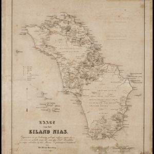
Kaart van het Eiland Nias
event
1857
location_on
Indonesia
Kaart van de Afdeeling Billiton (of Blitong)
event
1856
location_on
Indonesia
close
Refine your results
Collections
check_box_outline_blank
Bodleian Libraries, University of Oxford
1
check_box_outline_blank
Leiden University Libraries
1
Date
Filter from
1856
to
1857
Current results range from
1856
to
1857
Date range begin
Date range end
Language
check_box_outline_blank
Dutch
2
Location
Simple Location
check_box_outline_blank
Indonesia
2
Detailed Location
check_box_outline_blank
Dutch East Indies
2
check_box_outline_blank
Belitung
1
check_box_outline_blank
Billiton (of Blitong)
1
check_box_outline_blank
Liat Island
1
check_box_outline_blank
Mendanau Island
1
check_box_outline_blank
Nias
1
check_box_outline_blank
Pulau Liat
1
check_box_outline_blank
Sumatra
1
Land Use
Settlement Features
check_box_outline_blank
Kampong/Village
2
Cultivation/Extraction
check_box_outline_blank
Mining
1
Land and Sea Routes
Land Routes
check_box_outline_blank
River
2
check_box_outline_blank
Road
1
Sea Routes
check_box_outline_blank
Bathymetry
1
check_box_outline_blank
Maritime Route
1
Cultural and Political Regions
Cultural Regions
check_box
[remove]
Race/Ethnicity
2
check_box_outline_blank
Population Density
1
check_box_outline_blank
Religious Groups
1
Political Regions
check_box_outline_blank
District/Administrative Border
2
Environmental Features
Land Features
check_box_outline_blank
Mountain/Volcano
2
Sea Features
check_box_outline_blank
Reef
1
check_box_outline_blank
Shoal
1
Insets and Attributes
Insets
check_box_outline_blank
Legend
2
check_box_outline_blank
Elevation
1
Map Attributes
check_box
[remove]
Contour Lines/Elevation
2
check_box_outline_blank
Scale
2
check_box_outline_blank
Longitude and Latitude
1
check_box_outline_blank
Written Note/Details
1
Map Production Details
Map Maker
check_box_outline_blank
Cronenberg, F.
1
check_box_outline_blank
Melvill van Carnbee, Pieter
1
check_box_outline_blank
Rosenberg, H.C.B. von
1
check_box_outline_blank
Wiemans, W.D.
1
check_box_outline_blank
Wolff
1
Printer/Publisher
check_box_outline_blank
D. Heyse
1
check_box_outline_blank
Genie
1
check_box_outline_blank
Van Haren Noman & Kolff
1
Place of Publication
check_box
[remove]
Batavia
2