Search

Search Results

Map of the Kingdom of Siam and its dependencies

eventc.1900

location_onMyanmar, Malaysia, Singapore, Thailand, Laos, Cambodia, Vietnam

The border of the Kingdom of Siam (Thailand) and its internal administrative districts are highlighted in yellow. Inset maps show the cities of Bangkok, Chiengmai (Chiang Mai) and Luang Pra Bang (Luang Prabang) in more detail.

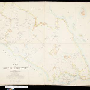
Map of Johore Territory 1893

event1893

location_onMalaysia, Singapore

Map of the Malay state of Johor, and Singapore. The route of a proposed railway north from Johor Bahru is shown. Apart from rivers and mountains, much of the terrain is blank, with labels such as ‘Unexplored Hill Country’ or ‘Dense Jungle and Swamp’.

New Sketch Map of the Protected Malay State of Perak

event1892

location_onMalaysia

Map of the state of Perak (Malay Peninsula) with a table of statistics: area, population, road/railway/river lengths, revenue, tin exports. Gold and tin mines are marked, and the Straits Settlements are highlighted in red.

New sketch map of the protected Malay State of Perak

event1892

location_onMalaysia

Map of state of Perak (Malay Peninsula) with a table of statistics: area, population, road/railway/river lengths, revenue, tin exports. Straits Settlements highlighted red. Someone has added handwritten travel times/distances by steamer/road/train.

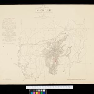
Map to show lines of advance on Manipur

event1891

location_onMyanmar

Map of three routes taken by British troops through the mountains to the Indian city of Manipur (Imphal) during the Anglo-Manipur War of 1891. The map includes part of Burma to the east.

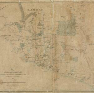
Map of the Malacca territory

event1878

location_onMalaysia

A late 19th century map of the town of Malacca and its surrounding area, including jungles, forests, mountains, rivers, roads, villages, tapioca estates and factories, and police stations. There is even a leper hospital on an island off the coast.

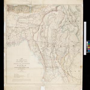
A map shewing the various routes proposed for connecting China with India and Europe through Burmah and developing the trade of Eastern Bengal, Burmah and China

event1875

location_onMyanmar, Thailand

A map of proposed trade routes through Burmah (modern Myanmar) intended to connect China to India and Europe. The border between India and Burmah is marked as being ‘unexplored’ and ‘undefined’. A table lists the distances between various cities.

Extension of the Electric Telegraph to Canton, Hong Kong, etc. from the Port of Rangoon

event1860

location_onMyanmar, Cambodia, Indonesia, Laos, Malaysia, Singapore, Thailand, Vietnam

Map of a proposed extension of a telegraph system from Rangoon (Yangon, Myanmar) to China. Includes current and projected railways, steam ship routes, and population figures for western China. From the British magazine ‘The Illustrated London News’.

close

  • Filter from 1860 to 1900

Current results range from 1860 to 1900