Search Results

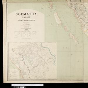
Soematra, Bangka en de Riouw-Lingga Archipel
1897
Malaysia, Indonesia, Singapore, Myanmar
Map of Sumatra and surrounding islands, with residencies—administrative districts—shown by coloured borders. There are inset maps of two residencies surrounding Padang, and of Groot-Atjeh (Aceh). Rivers, railways, roads and settlements are marked.

Algemeene kaart van Nederlandsch Indië
1879
Cambodia, Indonesia, Papua New Guinea, East Timor, Southeast Asia, Thailand, Malaysia, Philippines, Laos, Vietnam, Singapore, Brunei, Myanmar
A late 19th century map of the Dutch East Indies on four sheets, detailing maritime routes around the region. There are also inset maps showing railways, rivers, roads, and telegraph systems, as well as individual islands and cities.

Nederlandsch Oost-Indië
1865
Brunei, Cambodia, East Timor, Indonesia, Laos, Malaysia, Myanmar, Vietnam, Thailand, Southeast Asia, Singapore, Philippines, Papua New Guinea
This detailed map of the Dutch East Indies in the mid-19th century contains a great deal of information: topographical details, settlements and administrative areas, roads, railways and maritime routes, telegraph lines, inset maps etc.

Malay Archipelago, or East India Islands
1851
Brunei, Cambodia, East Timor, Indonesia, Laos, Malaysia, Myanmar, Papua New Guinea, Philippines, Singapore, Southeast Asia, Thailand, Vietnam
This mid-19th century map of Southeast Asia is illustrated with drawings of indigenous people from New Guinea, a ‘bee bear’ (probably a sun bear), a sailboat in front of Victoria Mount in New Guinea, and a village and palm trees in Sarawak, Borneo.


