
Search Results


Kaart van de Vallei van Pidië, de Moekim VII en de Vallei van Tangsé
1899
Indonesia
Large-scale topographic map of the northeast coast of Sumatra around the city of Sigli, Aceh, spread over 16 sheets plus a cover sheet of the whole area. The map focuses on two river valleys, mountains, marshland, villages and rice paddies.


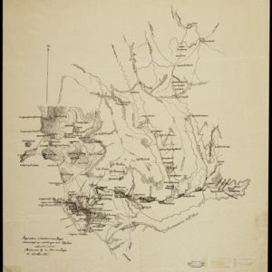


Kaart van het gebied bezet in Groot-Atjèh
1898
Indonesia
A large-scale map of Groot-Atjceh, northern Sumatra, spread over six sheets, and featuring details such as routes, crops (rice, banana, sugarcane, alang-alang, bamboo), mountains and wetlands, and settlements (city of Kota Radja (modern Banda Aceh)).

Map of the Island of Singapore and its dependencies
1898
Singapore
Map of Singapore Island, divided into Districts, including the surrounding islands and straits. The city centre, roads and forests are marked. MacRitchie Reservoir is at the centre of the island, with coconut plantations along the east coast.

Noordkust Java: Westervaarwater van Soerabaja
1898
Indonesia
This map of the Madura Strait between Java and Madura is designed to aid navigation: bathymetry (water depth), lighthouses, shoals and reefs, rocks and mud, anchor points, and landmark mountains are all marked. Text describes the tidal conditions.
- Filter from 1775 to 1899
- [remove]Kampong/Village242
- Residential Area70
- Post Office61
- Cemetery/Columbarium50
- Military Fort50
- Hospital29
- Military Barracks27
- Church23
- Mosque22
- Temple22
- Jail/Prison19
- Police Station14
- Public Space12
- Palace11
- more Settlement Features »
- [remove]Contour Lines/Elevation242
- Scale219
- Longitude and Latitude192
- Written Note/Details60
- Compass Rose28
- Rhumbline Network2


