Search

Search Results

A chart of north-west coast of Borneo: from Balambangan to Borneo proper

event1794

location_onMalaysia

Nautical charts, like this late 18th century example of the north-west coast of Borneo, were designed to help ships navigate. The numbers marked along the coastline and sea routes indicate the depth of the sea (bathymetry).

Plan of Pulo Condor

event1794

location_onVietnam

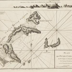
There is a port at the south of this map of the Côn Đảo archipelago (Vietnam), and notes giving details such as a suitable location to careen ships (turning a ship on its side for cleaning or repair). A ruined English fort is also marked.

Sketch of the Straits of Gaspar

event1794

location_on-

Map of the Gaspar Strait, off the east coast of Sumatra. The web of lines is a rhumbline network, numbers indicate sea depth (bathymetry), and there are side views of islands (elevations), all to aid navigation. Five 18th century routes are marked.

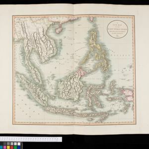
A new map of the East India Isles

event1801

location_onBrunei, Cambodia, East Timor, Indonesia, Laos, Malaysia, Myanmar, Vietnam, Thailand, Southeast Asia, Singapore, Philippines

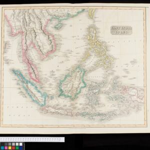
An early 19th century map by the English cartographer John Cary, highlighting the mountain ranges and rivers of Southeast Asia. The map also features many place names of cities, towns and islands.

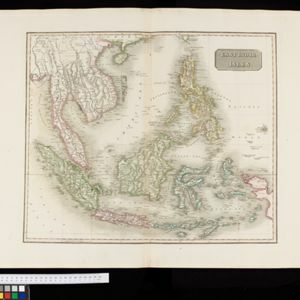
East India Isles

event1817

location_onBrunei, Cambodia, East Timor, Indonesia, Laos, Malaysia, Myanmar, Vietnam, Thailand, Southeast Asia, Singapore, Philippines

This early 19th century map was based on an earlier map by the English cartographer John Cary. It highlights the mountain ranges and rivers of Southeast Asia, and also features many place names of cities, towns and islands.

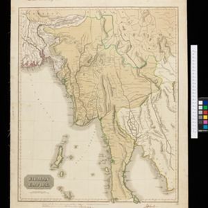
Birman Empire

event1824

location_onCambodia, Myanmar, Thailand, Vietnam, Laos

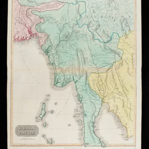
This map of the Burman Empire (Myanmar) features mountains, forests and rivers, as well as borders with Siam (Thailand) and Laos. Text notes how far up rivers boats can reach (‘Boats reach hither from the Sea’), ruby mines and rice fields.

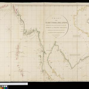
Chart of the East India Islands: exhibiting the several passages between the Indian and Pacific Oceans

event1824

location_onBrunei, Cambodia, East Timor, Indonesia, Malaysia, Philippines, Singapore, Thailand, Vietnam, Southeast Asia, Myanmar

To aid navigation, this map shows small islands, shoals and reefs, maritime routes for use during monsoons or at particular times of the year, bathymetry (sea depth), past explorers’ routes, shipwrecks and text about monsoons, typhoons and currents.

Birman Empire

event1829

location_onMyanmar, Thailand, Laos, Vietnam, Cambodia

This map of the Burman Empire (Myanmar) features mountains, forests and rivers, as well as borders with Siam (Thailand) and Laos. Text notes how far up rivers boats can reach (‘Boats reach hither from the Sea’), ruby mines and rice fields.

East India Isles

event1829

location_onBrunei, Cambodia, East Timor, Indonesia, Laos, Malaysia, Myanmar, Vietnam, Thailand, Southeast Asia, Singapore, Philippines

From ‘Thomson’s New General Atlas’, this mid-19th century map was based on an earlier map by the English cartographer John Cary. It highlights the mountain ranges and rivers of Southeast Asia, and also features many place names.

Birman Empire & countries south east of the Ganges

event1831

location_onCambodia, Indonesia, Laos, Malaysia, Myanmar, Thailand, Vietnam

This map of mainland Southeast Asia is divided into colour-coded regions. The Birman Empire (Myanmar) is the most detailed, with internal regions, rivers including the Irrawaddy, mountains and settlements marked.

Reduzirte Karte von den Philippinen und den Sulu Inseln

event1832

location_onMalaysia, Indonesia, Philippines

Maritime map of the Philippines, with inset maps of bays showing bathymetry (sea depth), shoals, reefs and anchor points. There is also an inset map of Taal Volcano, and elevations (side views of terrestrial landmarks like mountains and islands).

China, Birmah and Anam

event1835

location_onCambodia, Laos, Myanmar, Thailand, Vietnam, Philippines

Coloured borders are used on this map to divide mainland Southeast Asia into empires and kingdoms. Mountains, rivers and major settlements are shown in land, with islands, shoals and reefs marked in the South China Sea.

close

  • Filter from 1794 to 1900

Current results range from 1794 to 1900