Map of Asia: Printed for the New York Central's 'Four-Track Series'
event1900
location_onMalaysia, Indonesia, Thailand, Myanmar, Cambodia, Vietnam, Papua New Guinea, Philippines, Singapore, Brunei, Laos, Southeast Asia
Sketch map of China and adjoining regions: showing the density of population, mineral resources, chief products, principal trade routes, existing and projected railways, and inland navigation
event1898
location_onMyanmar, Thailand, Vietnam
Atlas van Nederlandsch Oost-Indië
eventc.1897-1904
location_onIndonesia
Kaart van den Nederlandsch Oost Indischen archipel aantoonende de door de Inlandsche bevolking beleden godsdiensten
event1896
location_onIndonesia
Kaart van de dichtheid van bevolking van Java en Madoera
event1892
location_onIndonesia
Asiatic archipelago
event1876
location_onVietnam, Myanmar, Papua New Guinea, Philippines, Singapore, Southeast Asia, Thailand, Malaysia, Laos, Indonesia, East Timor, Cambodia, Brunei
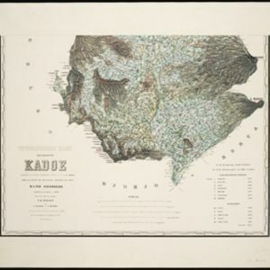
Topographische kaart der residentie Kadoe
event1870
location_onIndonesia
Asiatic archipelago
event1858
location_onVietnam, Myanmar, Papua New Guinea, Philippines, Singapore, Southeast Asia, Thailand, Malaysia, Laos, Indonesia, East Timor, Cambodia, Brunei
Kaart van de Afdeeling Billiton (of Blitong)
event1856
location_onIndonesia
Asiatic archipelago
event1840
location_onVietnam, Myanmar, Papua New Guinea, Philippines, Singapore, Southeast Asia, Thailand, Malaysia, Laos, Indonesia, East Timor, Brunei, Cambodia
Map of Asia: Designed to accompanying Smith's Geography for Schools
event1839
location_onBrunei, Cambodia, Indonesia, Laos, Malaysia, Myanmar, Philippines, Singapore, Thailand, Vietnam, Southeast Asia
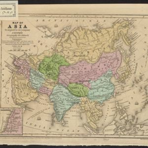
Map of Asia: Designed to accompanying Smith's Geography for Schools
event1839
location_onBrunei, Cambodia, Indonesia, Laos, Malaysia, Myanmar, Philippines, Singapore, Thailand, Vietnam, Southeast Asia