
Search Results


Index to relative positions of gold mining & prospecting grants: District Katha
1893
Myanmar
Map of the Katha district, Burma (Myanmar), with locations of gold mines and land allocated for prospecting. High points are marked and linked with lines to create a triangulation network. The Mu Valley State Railway and Mu River are shown.

Portion of coal fields tract: Upper Chindwin district
1892
Myanmar
A map surveying coal fields close to the Chindwin River in Upper Burma (Myanmar). Mountains are shown by using hachures: short lines/dashes that give a sense of the shape and steepness of terrain. Survey stations are marked with their height.

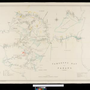
Skeleton map of the Burma and Assam frontier
1891
Myanmar
Map of Upper Burma showing the border with Assam (India) and China. The names of indigenous peoples are shown (‘Singphos’), along with the Irrawaddy River, railways and resources (‘Teak Forests’, mines (silver, copper, sulphur, rubies, coal, jade)).

Kaart van den Nederlandsch-Indischen Archipel
1890
Indonesia, East Timor, Brunei, Cambodia, Malaysia, Philippines, Singapore, Southeast Asia, Thailand, Vietnam
The seas of the Dutch East Indies are the focus of this map, with maritime routes, sea temperature, sea depth, currents and monsoons shown. There are graphs of population by ethnicity, agriculture and livestock, trade and shipping, and trade exports.

Kaart der Bataklanden en van het eiland Nijas
1890
Indonesia
A large-scale map of northern Sumatra, spread over 16 sheets, and divided into administrative regions. The island of Nijas (Nias) is marked with the locations of local tribes, and there is a list of other maps referenced in producing the map.


Kaart van den vierkanten paal (I en II) gouvernements grondgebied te Sintang
1888
Indonesia
The Kapoewas (Kapuas) and Melawi rivers converge on this map of the town of Sintang, Borneo. The town lines the river banks, and is surrounded by fields, forest and marshland. Arrows on the rivers mark the direction of their flow.

Kaart van den vierkanten paal gouvernements-grondgebied te Montrado
1887
Indonesia
A map of government land around the town of Montrado, Borneo, a gold mining centre in the 19th century, as shown by the number of gold mines (‘goudmijn’) marked. There are also crops—coconut, alang-alang, bamboo—and agricultural and fish ponds.

- Filter from 1535 to 1900
- [remove]Longitude and Latitude72
- [remove]Scale72
- Written Note/Details42
- Contour Lines/Elevation30
- Compass Rose22
- Rhumbline Network3


