Search Results
Filter
Map Attributes
Longitude and Latitude
Remove constraint Map Attributes: Longitude and Latitude
Commerce
Office
Remove constraint Commerce: Office
Land Routes
Path
Remove constraint Land Routes: Path
Settlement Features
Post Office
Remove constraint Settlement Features: Post Office
Settlement Features
Temple
Remove constraint Settlement Features: Temple
3 Results found

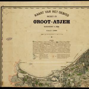
Kaart van het gebied bezet in Groot-Atjeh
1895
Indonesia
A large-scale map of Aceh, north Sumatra, spread over four sheets with details such as routes (rivers, roads, railways), crops (rice, banana, pepper, sugarcane, bamboo), land features (mountains, forests, wetlands) and settlements (cities, villages).

Topographische kaart der residentie Besoeki
1888
Indonesia
The residency of Besoeki (Besuki), East Java, featuring crops (rice, alang-alang, bamboo, coconut); fishing ponds; factories, warehouses, businesses; routes, administrative borders; churches, cemeteries, forts, lighthouses; mountains, rivers, lakes.


