
Search Results
Filter
Map Attributes
Longitude and Latitude
Remove constraint Map Attributes: Longitude and Latitude
Cultivation/Extraction
Plantation/Forestry Area
Remove constraint Cultivation/Extraction: Plantation/Forestry Area
Detailed Location
Java
Remove constraint Detailed Location: Java
Detailed Location
Sulawesi
Remove constraint Detailed Location: Sulawesi
Detailed Location
Western New Guinea
Remove constraint Detailed Location: Western New Guinea
Simple Location
Cambodia
Remove constraint Simple Location: Cambodia
Simple Location
Southeast Asia
Remove constraint Simple Location: Southeast Asia
11 Results found


The geographical distribution of plants according to Humboldt's statistics of the principal families and groups: Schouw's twenty five phyto-geographic regions, and the distribution of the family of palms and the genera Pinus (pine) & Erica (heath)
1849
Brunei, Cambodia, East Timor, Indonesia, Laos, Malaysia, Myanmar, Papua New Guinea, Philippines, Singapore, Southeast Asia, Thailand, Vietnam

Survey of the geographical distribution and cultivation of the most important plants which are used as food for man: with indications of the isotheres & isochimenes, or lines of equal summer & winter temperature
1849
Brunei, Cambodia, East Timor, Indonesia, Laos, Malaysia, Myanmar, Papua New Guinea, Philippines, Singapore, Southeast Asia, Thailand, Vietnam


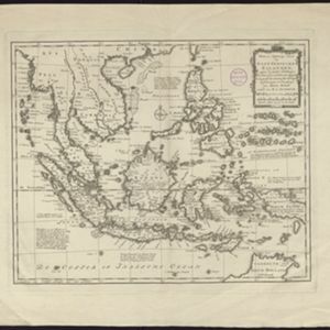


A map of the East-Indies and the adjacent countries: with the settlements, factories and territories, explaning what belongs to England, Spain, France, Holland, Denmark, Portugal &c.
1720
Brunei, Cambodia, East Timor, Indonesia, Laos, Malaysia, Myanmar, Philippines, Vietnam, Thailand, Southeast Asia, Singapore


- Filter from 1633 to 1890
- Brunei11
- [remove]Cambodia11
- East Timor11
- Indonesia11
- Malaysia11
- Philippines11
- Singapore11
- [remove]Southeast Asia11
- Thailand11
- Vietnam11
- Laos10
- Myanmar10
- more Simple Location »
- Borneo11
- [remove]Java11
- [remove]Sulawesi11
- Sumatra11
- [remove]Western New Guinea11
- Celebes10
- Malay Peninsula8
- Pegu8
- Siam8
- Ava6
- Maluku Islands5
- Sunda Islands5
- more Detailed Location »
- Crops11
- [remove]Plantation/Forestry Area11
- Mining9
- Domesticated Animals3
- Fishing1
- [remove]Longitude and Latitude11
- Written Note/Details11
- Scale9
- Compass Rose8
- Rhumbline Network2


