
Search Results

Carte des Royaumes de Siam, de Tunquin, Pegu, Ava, Aracan &c.
c.1755
Cambodia, Laos, Malaysia, Myanmar, Thailand, Vietnam
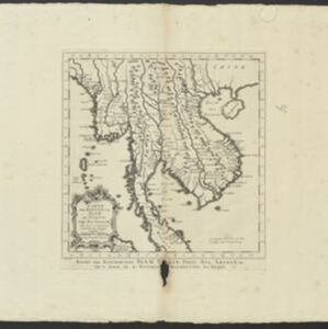
The kingdoms of mid-18th century mainland Southeast Asia are shown on this map: Ava and Pegu (Myanmar), Siam (Thailand), Tonquin and Cochinchine (Vietnam), Camboie (Cambodia) and Laos. The text is in French, with the title also in Dutch at the base.
Carte des Royaumes de Siam, de Tunquin, Pegu, Ava, Aracan &c.
c.1755
Cambodia, Laos, Malaysia, Myanmar, Thailand, Vietnam
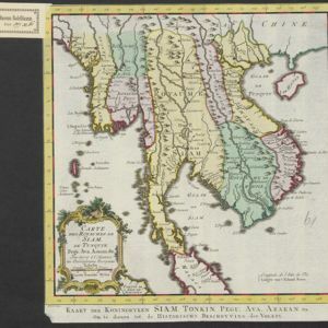
The kingdoms of mid-18th century mainland Southeast Asia are shown on this map: Ava and Pegu (Myanmar), Siam (Thailand), Tonquin and Cochinchine (Vietnam), Camboie (Cambodia) and Laos. The text is in French, with the title also in Dutch at the base.
Carte des costes de Cochin Chine, Tunquin, et partie de celles de la Chine
1747
Vietnam, Cambodia
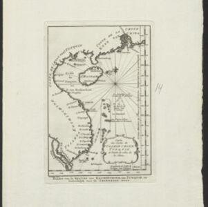
Map of the eastern coast of mainland Southeast Asia (modern Vietnam and part of Cambodia), divided into Tsiampa, Kochinchine and Tunquin. The shoals and reefs of the Paracel Islands are marked. The text is in French and Dutch.
- [remove]Cartouche4
- Elevation1
- Illustration1
- Legend1
- [remove]Longitude and Latitude4
- Scale3
- Compass Rose2
- Contour Lines/Elevation1
- Written Note/Details1


