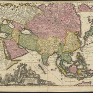
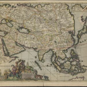
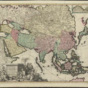
Nieuwe kaart van Asia volgens de laatste ontdekkingen
1764
Brunei, Cambodia, East Timor, Indonesia, Laos, Malaysia, Myanmar, Philippines, Singapore, Southeast Asia, Thailand, Vietnam
Map of Asia divided into large colour-coded regions: the western half of mainland Southeast Asia is joined with India (‘Indien’), and coloured red; the eastern half is joined with China, all in yellow.